
The Toughest Hiking Trails in Yosemite Valley
Table of Contents
Update Summer 2020: In light of the global COVID-19 pandemic, Yosemite has instituted a reservation system for all park entrances. This system is to reduce vehicle and human traffic, thereby lowering the risk of virus transmission within the park. All vehicle traffic entering Yosemite must secure a permit ahead of time, or else they will be turned away at the gate. Any visitor in the park found without a permit will be subject to a heavy fine.
Entrance Reservations can be made at the official Yosemite National Park website.
The hardest hikes in Yosemite Valley are, on average, more difficult that the hardest hikes in other National Parks. Owing largely to the elevation change, the giant, sheer granite walls, and fast changing weather patterns, hiking in Yosemite is a challenging affair. Taking on these hikes requires fitness, determination, and a degree of mental toughness.

I’ve spent a lot of time hiking all over Yosemite National Park. In my wanderings, I’ve probably hiked all of Yosemite Valley’s trails at least once, but I’ve hiked the best ones multiple times. These trails are so good, that even after a challenging, calf burning ascent, you will want to come back to conquer them again and again.
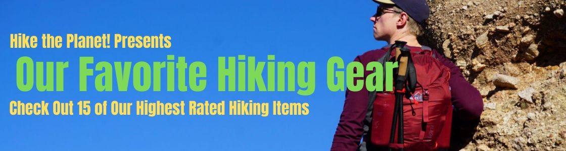
Need New Hiking Gear?
Click the Banner Below to see our highest rated Hiking Gear. Whether we’re in Yosemite Valley, or taking a stroll on the local trails, this is the gear that we never leave home without.
5. Four Mile Trail-The Hardest Way to Glacier Point

Distance: 4.6 Miles
Elevation Gain:2,828 Feet
Spoiler Alert: The Four Mile Trail is actually longer than 4 miles. It’s about 4.6 miles, in fact. The trail may be misnamed, but it is still worth hiking. The Four Mile Trail begins at the floor of Yosemite Valley, not far from the Swinging Bridge Picnic Area. This hike snakes it’s way up an obvious weakness in the valley walls, through talus slopes, and granite gullies, before concluding with a breathtaking finish at Glacier Point.
The Four Mile Trail, in my estimation, is the easiest of Yosemite Valley’s toughest hiking trails, but unlike the other hikes listed here, the views stay consistent throughout the trip. Initially, El Capitan dominates the view. As the trail climbs higher, Yosemite Falls, Half Dome, Royal Arches, The Sentinel and Tenaya Canyon join the Skyline.
About 3/4 of the way up (if starting this hike from the Valley Floor), a small side trail brings hikers to Union Point-a great overlook, and a nice spot to have a picnic. Glacier Point is not far beyond Union Point, and as you approach, the iconic Diving Board comes into view. To get this high, some people need to go Rock Climbing, but as the expert hiker, all you need to do is walk here.
Finish your hike with an Ice Cream sandwich at the Glacier Point gift shop. You’ve earned it.
Taking the Four Mile Trail is a way to access other trails near Glacier Point, like the Sentinel Dome Trail, and the Panorama Trail.
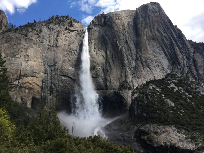
4. Upper Yosemite Falls-Hike North America’s Tallest Waterfall
Distance:4.20 Miles
Elevation Gain:3,018 Feet
Yosemite Falls, believe it or not, is the tallest waterfall in North America. It’s great drop plunges 2,425 feet to the Yosemite Valley floor. ‘The Falls’ are fed by Yosemite Creek, a major tributary of the Merced River that originates high in the Yosemite Backcountry.
Getting to the top of Yosemite Falls is not an easy task. Unlike the simple amble to Lower Yosemite Falls, the hike to the top is long, complete with switchbacks, sun exposure, and plenty of elevation gain. The trail is crowded, and you may notice a constant spray during peak flow season.
Earning your way to the top of the Upper Yosemite Falls Trail is will challenge every faculty of your hiking prowess. If you can make it all the way, end your hike at the dizzying edge of Yosemite Falls. The roar of these Falls can be heard ringing throughout the Valley, but you are lucky enough to be standing right at the source of it. Look over, and try to imagine the sheer amount of water falling into the abyss. It’s mind bending, and kind of scary.
You won’t be alone on this hike. Many people attempt to scale Upper Yosemite Falls every year. It’s popularity rivals even that of the Hollywood Sign Hike.
For extra challenge points, continue an extra mile from the top of Yosemite falls to Yosemite Point. Yosemite Point is a cool viewing spot, similar to Taft Point. This vantage permits great views of Half Dome, and the High Sierra.
3. Mist Trail-Classically Wet

Distance:3 Miles, Out and Back
Elevation Gain:1,909 Feet
The Mist Trail ascends two great waterfalls-Vernal Falls, and Nevada Falls. This trek is known for spray-the plumes of moisture enveloping portions of the trail. Mist Trail veterans are well familiar with this unique quality. You’ll hear campfire tales of soaked clothing and slippery stairs, of dizzying overlooks and eternally closed-for-maintenance trail side restrooms. The Mist Trail carries with it a reputation, but is a must do hike.
Relatively speaking, the length and elevation gain are quaint, and even the other trails on this list are both longer, and taller. Whatever you do, don’t underestimate this hike, because it really packs in the difficulty. Step for step, the Mist Trail lays on a decent challenge. The Mist Trail is dense, denser than cheesecake, but a little less so than solid lead.
The Mist Trail is a gateway hike. No, not gateway drug, but it acts as the gateway to many other Yosemite hiking objectives. Think of it as a prerequisite trail. If you can hike the Mist Trail, then you gain access to Half Dome, Clouds Rest, huge chunks of the Yosemite Backcountry, and even the John Muir Trail.
The Mist Trail is shorter, yes, but it is full of beauty. Hiking the Mist Trail is best performed by those who only have a short time in Yosemite, or are using it to access destinations and trails a bit further afield.

2. Half Dome-Yosemite’s Most Famous Hike

Distance: 14 Miles Round Trip
Elevation Gain: 5,000 Feet
Half Dome might as well be the most iconic hike in America, making it a top contender for the most well known hike in the entire world. The looming northwest face of Half Dome is visible from all over the Valley, beckoning anyone up for the challenge to claim the summit.
Hiking Half Dome involves braving your way up the infamous Cables Route. Installed into the rock are metal cables, making an otherwise fifth class slab climb to the summit a harrowing day hike. The Half Dome cables are exposed, death defying, but otherwise accessible path up the back side of the formation.
The top of Half Dome is a large, flat surface, high above anything else in Yosemite Valley. Hikers have a great view of every nearby landmark. Those willing to tempt fate can sneak up to the edge of Half Dome’s face, and peer down the gigantic sheer drop.
Half Dome attracts so many hikers that the National Park Service has had to institute a permit system. In an effort to reduce crowds, as well as impact on the trail, hikers need to enter a permit lottery. Those lucky enough to secure a permit can then hike Half Dome on their chosen day. Permits are checked by a ranger near the base of the cables. With 300 hiking permits given out each day of the season, the chances of nabbing a spot are good.
Didn’t score a Half Dome Permit? No Seat. Here are 7 Different Ways to Hike Half Dome Without a Permit if you got unlucky in the pre-season permit lottery.
1. Cloud’s Rest-Biggest Challenge, Smallest Crowds

Distance: 19.8 Miles Out and Back
Elevation Gain: 5,346 Feet
Cloud’s Rest, like so many other trails, has a nice name. Clouds are pleasant and fluffy, and resting is what you do when you’re tired. But when you put them together, you get a hike that is long, difficult, and remote. The Clouds Rest Trail from Yosemite Valley embodies these qualities to such a degree, that I’d place it as the toughest day hike in Yosemite Valley. It even edges out Half Dome for the top spot.
Clouds Rest and Half Dome are similar hikes, with similar views at the end. Clouds Rest, though is higher up, more difficult to reach, and, best of all, does not require any permits. Your journey to Clouds Rest (and trust me, it will feel like a real journey) begins at the equally harmless sounding Happy Isles. The Mist Trail is then taken to the John Muir Trail.
Hike the John Muir Trail until a sign indicates the intersection with the Clouds Rest Trail. From here, the trail switchbacks through endless manzanita, and cool granite slab country. The trail is tough, but persistent hikers willing to endure the distance and elevation gain will be rewarded with what is undoubtedly the most Epic View in Yosemite National Park.
My time atop Clouds Rest was spent gazing at the granite splendor all around. I took a lot of pictures, but not before laying down for a pleasant cat nap. No clouds were resting that day, but I sure was.
Bonus: Mt. Dana-Hike a 13’er!

Distance: 6 Miles Round Trip
Elevation Gain: 2,906 Feet
Yosemite may be the crown of California’s Sierra Nevada mountains, but it is unfortunately lacking in California 14ers. The next best thing, aside from driving south to Mt. Whitney is to hike a 13er!
At 13,061 feet, Mt. Dana proudly takes the spot of the second highest peak in Yosemite National Park, right after Mt. Lyell. Mt. Dana is conveniently accessed off of Tioga Pass road (highway 120). Park your car at Yosemite’s East Entrance, and take a trail heading south towards the giant mountain right in front of you.
The majority of the Mt. Dana is in High Sierra alpine, and the elevation gain rarely lets up. High Elevation, and a rough talus trail makes hiking Mt. Dana a unique challenge, but reaching the top rewards determined hikers.
Mt. Dana’s views are the best in the park, even better than Clouds Rest. Mammoth Lakes, the High Sierra, Tuolumne, and Mono Lake can all be spotted from the summit. On a clear day, even the distant Coast Ranges are visible on the western horizon.
Mt. Dana is out of the way of Yosemite Valley, but it is worth it to take some time to hike and scramble your way to this epic summit.
The Hardest Hikes Need the Best Gear

Yosemite has a hiking trail for everyone. Adventurers seeking to hike the most challenging trails will need to be well prepared. You’re gonna need Trekking Poles for those rocky sections, lightweight rain jackets for when the weather turns bad and, of course, the all important First Aid Kit. I’ve Assembled a List of the Best Hiking Gear, hand picked based on years of experience of hiking, camping, and rock climbing in Yosemite. Get the right gear for the best hiking trails!

- The Best Campsites Around Big Bear California - February 26, 2021
- Hiking to the Hollywood Sign Via the Brush Canyon Trail - July 13, 2020
- Dirt Cheap Hiking and Backpacking Gear: The Most Affordable Gear on the Internet - July 4, 2020
3 thoughts on “Yosemite’s Hardest Hikes: The 5 Trails That Will Challenge Your Fitness and Determination”
Comments are closed.