Top 10 Hiking Trails in Flagstaff, Arizona
Table of Contents
Update 7/29/2019: The July, 2019 Museum Fire has consumed many acres of National Forest land on the San Francisco Peaks, The Dry Lake Hills, and Mt. Elden. As a result, many of the hiking trails in the region, including sections of the Arizona Trail may be subject to closure while officials assess damage. We at Hike the Planet! ask that you do not hike in any closed areas, both to ensure your own safety, and to allow fire officials to do their job.
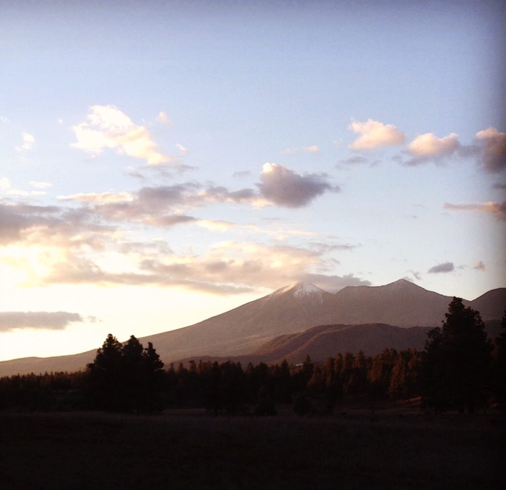
High in the American Southwest sits the little town of Flagstaff, Arizona. Surrounded by pine forests and lofty peaks, this little burg feels as though a slice of the Rocky Mountains has been chopped off, and dropped into the middle of Arizona.
The natural beauty of this region attracts outdoor lovers from all over. Whitewater Rafting, Mountain Biking, Rock Climbing, snow sports, and stellar hiking allow for all sorts of adventure.
Flagstaff is sandwiched right between Grand Canyon National Park, and Sedona, Arizona. Here, along the southern edge of the Colorado Plateau, a friendly outdoor community has established itself. The people that call Flagstaff home love the outdoors, all brought here by the great hiking, climbing, and skiing.
To help narrow down all the wonderful hiking opportunities found here, and with much deliberation and consideration, we have put together our Top 10 Favorite Hikes in Flagstaff.
Related: The Toughest Trails in Yosemite National Park
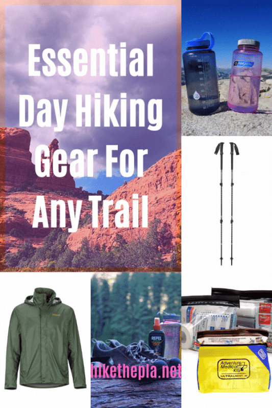
Looking for Hiking Gear? Click the image below to see our favorite hiking gear! This is the highest rated gear that we never go hiking without!
10. Fatman’s Loop
Distance: 2.5 miles
Difficulty: Easy to moderate
Pets?: Yes! But they must be kept on a leash.
For a quick, scenic Flagstaff day hike, the Fatman’s loop is a good choice. Sitting at the eastern foot of Mt. Elden, Fatman’s Loop is a 2.5 mile, gently sloping loop trail. The loop starts just off Highway 89, and gains 500 feet of elevation.
At it’s zenith, Fatman’s loop provides view of the East side of Flagstaff, the Sunset Crater region, and the painted desert. On the other side, the steep slopes of Mt. Elden tower above.
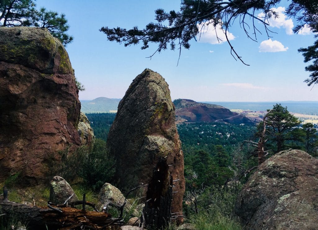
Fatman’s ecosystem is a mixture of desert and coniferous forest. Ponderosa Pines grow comfortably amongst cactus and juniper. The flora grows so thick in places, that it may feel like you’re hiking in an arid jungle. Animals seen along this trail include deer, elk, coyotes, and elusive Black Bear.
This trail is very popular with Flagstaff locals, so expect to be sharing the trail with hikers, joggers, mountain bikers, and dogs. Fatman’s also provides quick and easy access to the greater Mt. Elden trail system.
Fatman’s Loop Trail Directions
From Flagstaff, drive north on Highway 89. After you pass the Flagstaff mall, turn left into the Fatman’s Loop parking lot.
9. Kendrick Peak Trail
Distance 4.5 miles one way.
Difficulty Fairly Strenuous
Pets?: Yes! but they must be kept on a leash.
Kendrick Peak is another popular Flagstaff hike the climbs a big volcano. It rises out of the forests north of town, and offers a hiking experience similar to the San Francisco Peaks, but without the crowds. Like the Peaks, Kendrick Mountain is a big, extinct stratovolcano.
The trail takes you through pine woodland, and Aspen groves, all the while gently switch backing along volcanic cliff bands. The trail ends at a historic Forest Service Fire Lookout, where the hiker is rewarded with 360 degree panoramic views of the Grand Canyon, and the San Francisco Peaks.
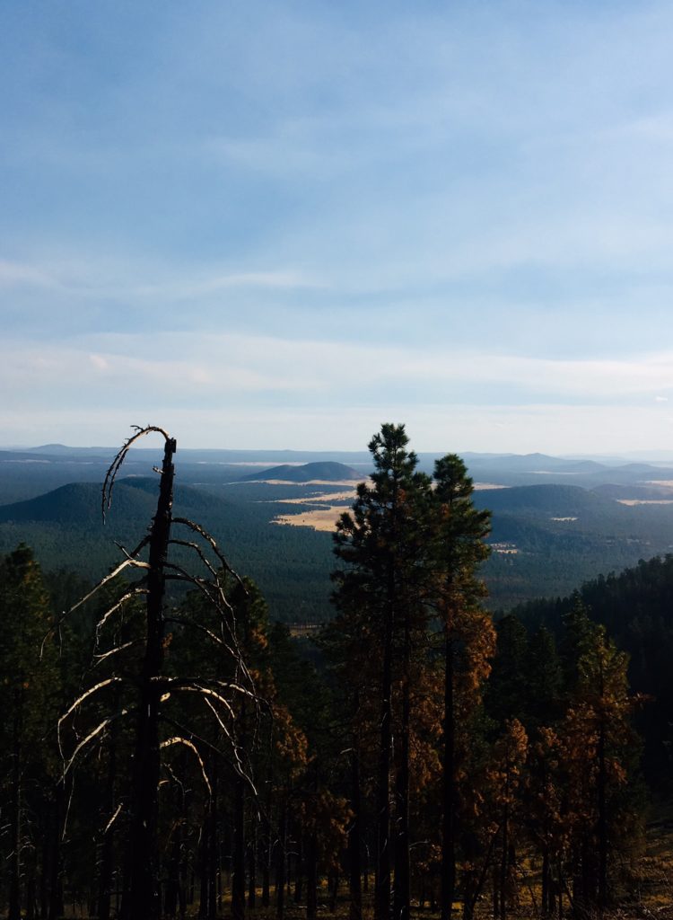
Kendrick, though a popular trail by Flagstaff standards, sees less hikers than the more renowned trails on the San Francisco Peaks. Come here for a quieter, though still strenuous hike. During an ascent one October afternoon, the author saw only one other hiker. Kendrick, like the Peaks, is a great place to view Fall colors.
Kendrick Peak Trail Directions
The Kendrick Peak Trail can best be reached by taking Highway 180 north of Flagstaff. After nine miles, turn left onto FR 245, as you would if you were heading to Lava River Cave. At the intersection, turn right onto FR 171, and follow the signs to the Kendrick Peak trailhead. The trailhead comes equipped with a parking area, and a pit toilet.
8. Kachina Trail
Distance: 5.5 miles one way
Difficulty Mostly easy.
Pets?: Yes! But they must be kept of a leash.
The Kachina Trail, traversing the southern slopes of the San Francisco Peaks provides the greatest reward to effort ratio of any trail in the region. Though not a short trail by any means, the trace of the Kachina Trail sees little elevation change relative to it’s length. For much of it’s length, this trail is a gentle, pleasant stroll through pine forest, aspen groves, cliff bands, and meadows.
From it’s perched position, the hiker gets views of Flagstaff and Oak Creek on one side, and the lofty heights of the Peaks on the other. This is a great trail to see the aspens change to Fall colors. If you’re lucky, you may get views of the elusive Black Bear, or even a Mountain Lion!
The Kachina Trail is named for the Kachina wilderness, which in itself is named for the Kachina Peaks, which is actually just another name for the San Francisco Peaks. According to the Hopi tribe, the San Francisco Peaks are home to the Kachinas-the various gods and deities of the Hopi Pantheon.
Throughout the year, the Kachinas travel between the San Francisco Peaks, and the Hopi Mesas, which are located in the painted desert Northeast of Flagstaff.
The Peaks are considered sacred not just to the Hopi, but to many tribes throughout Arizona, including the Navajo, and Zuni. When recreating on the peaks, please be respectful of any Native American artifacts or shrines that you may come across.
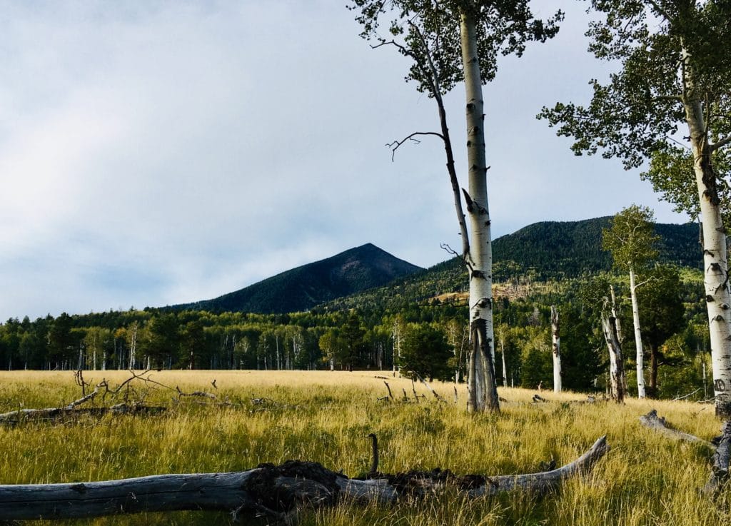
For a longer adventure, connect the Kachina Trail with the Weatherford and Humphreys Trail to from a long, loop trail suitable for backpacking. Be aware that there are very few water sources on the Peaks. Besides melted snow, you will need to pack in all your water. If you are one of those ultra athletic Trail Runner types, don’t be shy to run this loop.
Kachina Trail Directions
From Flagstaff, drive north on Highway 180. Turn right onto Snowbowl road. Drive to the resort. Turn right into the lower parking lots, and park at the far end of the lot. The Kachina Trail starts here, at the end of the parking lot.
Related: Outdoor Social Distancing during the COVID-19 Pandemic
7. Lava River Cave
Distance: Just under two miles out and back.
Difficulty Easy, after the initial scramble. Be aware of hidden ice.
Pets?: Not recommended to protect the fragile cave ecosystem.
In Flagstaff, there are no rivers, all the lava has cooled and hardened, and caves are generally regarded as dangerous places. A hike called “Lava River Cave” would then seem out of place in both time and space. Yet, out off of highway 180, north of Flagstaff is a hike named just that.
As it’s name might suggest, Lava River Cave is a river made of Lava in a cave. Sounds interesting? That’s because it is. It may be the most interesting hike in or around Flagstaff. In Flag, there are volcanoes all around, and lava flows have covered the Earth.
Lava River Cave is the remnant of an ancient underground magma “stream” that has bored out a cave within one such lava flow. This cave feature, known as a Lava Tube, are found in and around volcanoes everywhere. In Flagstaff, you can hike in one.
Lava River Cave begins in the forest north of town, south of Kendrick Peak. The trail begins at an enclosure surrounding a rocky hole in the ground. Here, you will find interpretive signage explaining the geology, ecology, and hiking conditions of the cave. A rocky scramble brings you through the entrance.
Almost immediately, the light dims, and the temperature drops. Here in the Lava Tubes, it remains a cool 30-40 degrees Fahrenheit all year long. Bring layers, sturdy boots, trekking poles/ a hiking stick, and most importantly, a light source, along with one or two backup lights.
Once you climb down past the rocky entrance, the trail evens out. The height of the ceiling varies, so be sure to watch your head. The hike is relatively short, totaling 1.5 miles out-and back. The Lava River Cave is a unique hiking experience, and is very popular as a result.
When hiking in the Lava River Cave, be mindful of it’s unique underground environment. The cave is home to a variety endemic plants and animals, including bats, mammals, and insects. Pack out your trash, and refrain from vandalizing or smoking in the cave.
Cave ecosystems are notoriously fragile, so do your best to reduce your impact. Though the cave is open year round, the best season to hike is summer, as the cool, dark cave can offer a refreshing reprieve from the summer heat.
Lava River Cave Directions
From Flagstaff, drive 9 miles north of Flagstaff. Turn left onto FR 245, found at milepost 230. At the intersection, turn left onto FR 171, and follow the signs to the Lava River Cave.
6. BearJaw-Abineau Loop Trail
Distance: 7.5 Mile Loop
Difficulty: Strenuous
Pets?: Yes, but dogs must be kept on a leash.
The Bearjaw-Abineau Trail is both the most strenuous, and isolated hike in Flagstaff. A loop trail connecting the remote, avalanche prone Bearjaw and Abineau canyons, Bearjaw-Abineau loop sits nestled on the northern slopes of the San Francisco Peaks.
Far from any large human settlements, the views, along with the remoteness and physical challenge, put this trail into the upper ranks of Flagstaff hikes.
After driving down a rutted out, dirt road for several miles, hikers reach the BearJaw-Abineau Loop trailhead. From here, hikers have the option of starting up BearJaw Canyon, and descending via Abineau Canyon, or visa versa. The choice is yours. Either way, you are in for a tough hike with great views.
The top of either canyon is connected to the other by the waterline road-a disused service road that circumnavigates much of the Peaks. The high point of this hike lends views of the Grand Canyon, the Painted Desert, and the oft-not-seen Northern and Eastern slopes of Humphrey’s Peak.
The Bearjaw-Abineau trail is a great spot to view some of Flagstaff’s Fall foliage. The tough, committing hike keeps many away, letting the adventurous enjoy their fall colors in peace. This trail is great for viewing wildlife, including coyote, elk, and Black Bear.
Bearjaw-Abineau Trail Directions
From Flagstaff, drive North on Highway 180. After 19.5 miles, turn right onto FR 151 (Hart Prairie Road). Continue for 1.5 miles, and turn left onto FR 418. After several miles, turn right onto FR 9123j. Follow the signs to the parking area. High clearance vehicles are recommended, although we encountered no problems reaching this trailhead in a Pontiac Coupe.
Related: Check out our list of Our Favorite Hiking Gear
5. Inner Basin & Lockett Meadow
Distance: 3 miles one way
Difficulty: Easy to Moderate
Pets?: Yes! But they must be kept on a leash.
Folding you into the very heart of the San Francisco Peaks is the Inner Basin and Lockett Meadow Trail. In this exploded, glacially carved valley sits what is perhaps the southwest’s most impressive Aspen grove.
Nestled between verdant, volcanic walls, the Inner Basin hosts a peaceful forest, an important aquifer, and impressive views of Arizona Alpine summits.
Thousands of years ago, what is today the San Francisco Peaks used to be a very large, very tall Stratovolcano. At some point, this volcano violently exploded, leaving a hollowed, collapsed Caldera.
Later, as the climate began to cool, and the Ice Age crept in, glaciers formed to further hollow and carve out this Caldera. The glaciers have since melted, leaving us with a lush, alpine valley to play around in.
Due to the presence of aforementioned beautiful Aspen Grove, the Inner Basin is a popular place to check out Fall Foliage. People flock from all around to check out the changing leaves, as beautiful as they are. In peak color, the golden yellow canopy of these Aspens casts a dreamy atmosphere in these mountains- a unique departure from the stark desert.
Don’t expect to find a parking spot during an October weekend, but do expect to wait in lines when driving up the narrow forest roads. Securing a campsite is out of the question.
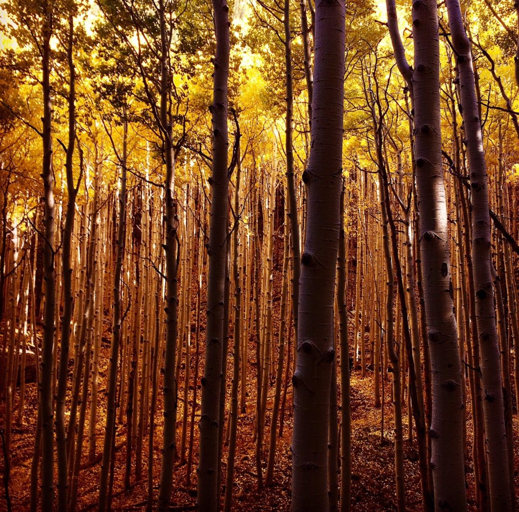
To hike this trail, simply park at the Inner Basin parking lot at the end of the Lockett Meadow road. Take the trail leading into the forest. As you gain altitude, the views become better and better. The Lockett Meadow and Inner Basin trail can be used to access the Weatherford Trail, where it connects below the Fremont Saddle. Animals frequently seen along this trail are deer, elk, black bear, and wild turkey. The real attraction, of course, is the heavenly Aspen Grove.
Inner Basin and Lockett Meadow Directions
Drive North from Flagstaff on Highway 89. Turn left at FR 522. Drive up this dirt road for a few miles, following the signs to Lockett Meadow. Turn right onto Lockett Meadow Road. Follow this narrow road to the Lockett Meadow parking lot. Expect traffic jams during busy Fall weekends.
4. SP Crater
Distance 1.3 Mile Loop
Difficulty Strenuous
Pets?: Yes, but they must be kept on a leash.
Sunset Crater is a spectacular place. It is a newborn volcano, geologically speaking, and visitors can see what a fresh volcanic landscape looks like. It’s great, if not for one flaw. The National Park Service does not allow visitors to hike to the summit of sunset crater, so as to preserve the volcano.
In my opinion, this is not such a bad policy, as it is important to preserve a geologic treasure like Sunset Crater. Fortunately, for those looking to hike and scramble all over a cinder cone, nearby SP Crater is a fine alternative.
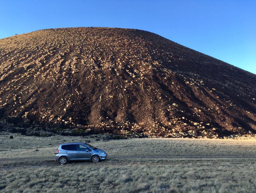
SP Crater sits northwest of sunset crater, and north of the San Francisco peaks. Here, the climate is considerably drier than the rest of the volcanic field. Few plants besides grasses and scattered Junipers grow. This dusty arena is home to unspoiled volcanic goodness, where the climate has done well to preserve the dozens of cinder cones that have emerged here.
SP Crater is probably the tallest and most impressive of these cones. From afar, SP crater looks like the quintessential image of a volcano. Tall, steep slopes, with a crater at the top.
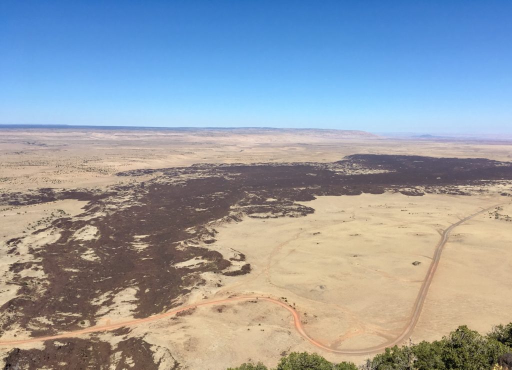
The name SP crater refers to the large lava flow that emerged from it’s northern slope. Early settlers believed that the large, black flow looked like spilled human waste. “SP” is an acronym for, well, you can figure it out.
Park at the northern base of the volcano. From here, scramble up the sides, following an obvious social trail. You’ll likely get cinders in your shoes, and the loose slopes will make upward progress slow, but keep at it. Once at the top, you can walk around the rim of the crater.
You’ll gain 360 degree views of Northern Arizona, including the Grand Canyon, the San Francisco Peaks, and the painted desert. Take a moment to admire the striking, chaotic flow of black lava emanating from SP Crater’s base. Most of the lava flows nearby have either eroded, or been obscured by vegetation growth, while this one has been wonderfully preserved by the drier climate.
SP Crater Directions
From Flagstaff, drive North on Highway 89. Drive past the turn off for Sunset Crater. Soon after you pass the turn off for Wupatki, turn left onto a dirt road at mile post 446. This is an unmaintained dirt road. Follow this road for several miles, following the most obvious path. Sunset Crater will be on your right. Keep an eye out for herds of Antelope.
Related: Hiking Red Butte near the Grand Canyon
3. Weatherford Trail
In my opinion, the Weatherford trail could easily take the top spot on this list. It is a longer trail, and offers a sample of every hiking environment found in the Flagstaff area. Hiking this trail feels like a multi—day backpacking experience, even though it is only a single day, out and back hike. If you only have a day to hike one trail in Flagstaff, I highly recommend this one.
Starting at Schultz Tank, the Weatherford Trail starts north towards the San Francisco Peaks. Soon, this trail begins switchbacking up Weatherford Canyon. Both the trail, this canyon, and downtown Flagstaff’s Weatherford Hotel are named for John W. Weatherford-one of Flagstaff’s earliest settlers and entrepreneurs.
The trail follows the course of the old Weatherford truck trail, which was constructed in the 1920’s to drive tourists up the mountain. This portion of the trail offers sweeping views of Flagstaff, Oak Creek Canyon, and the San Francisco Peaks.
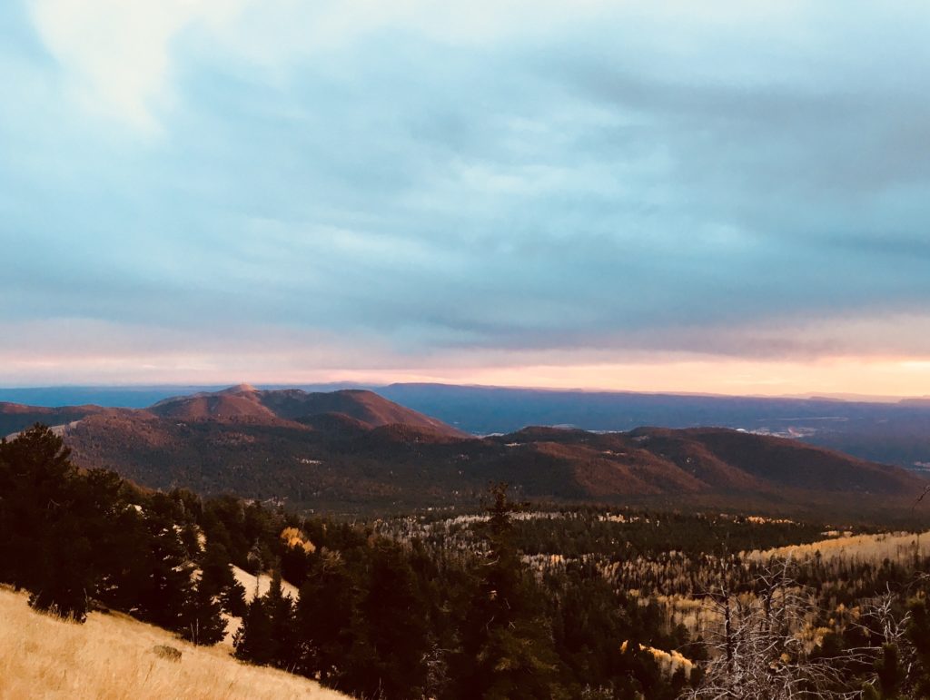
After ascending Weatherford Canyon, the trail crests Doyle Saddle, located between Doyle Peak, and Fremont Peak. Here, you can peer down into the lush Inner Basin, and west to Humphreys Peak. The trail resumes westward, dipping below the saddle, and entering a thick conifer forest.
Continue further to Fremont Saddle-another low point connecting Agassiz and Fremont Peaks. In my opinion, this spot has the best views of Flagstaff.
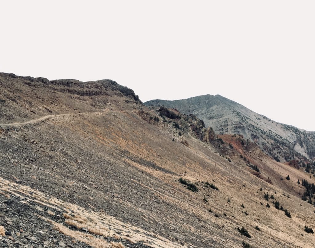
From here, the trail traverses along the eastern side of Mt. Agassiz. As you gain higher elevation, the forest gives way to sparse, alpine vegetation. You have just entered Arizona’s only region of Alpine Tundra. This region is home to the endangered San Francisco Peaks Groundsel-a hardy little plant found only in this small alpine region.
Take a minute to admire the bare, volcanic landscape, and interesting, crag like formations. The trail ends at the Humphreys Saddle. From here, you can connect onto the Humphreys Peak Trail, and continue one mile to the Humphreys Summit-the highest point in all of Arizona.
For a longer adventure, connect this trail with the Humphreys and Kachina Trails to create a grand San Francisco Peaks loop trail.
Distance: 10.6 Miles One Way
Difficulty: strenuous
Pets?: Yes!
Camping Yes, but not allowed above 11,600 feet.
Weatherford Trail Directions
From Flagstaff, drive north on Highway 180. Turn right onto Schultz Pass Road. After the turn off, this road quickly turns to dirt. After several miles, turn right into the Schultz Tank Parking lot. The Weatherford Trail starts here, heading North. Please be mindful of the private residences located along Schultz Pass road.
2. Humphrey’s Peak Trail
Here it is. The big Enchilada of Flagstaff trails. The head honcho. The Commander in Chief. The most sought after trail in all of Flag town. Humphrey’s Peak! For those not in the know, I will put you in the know. Mt. Humphrey’s is a big tall mountain sitting just north of town. Actually, it’s the tallest point in a group of very tall points, which coincidentally makes it the tallest point in all of Arizona.
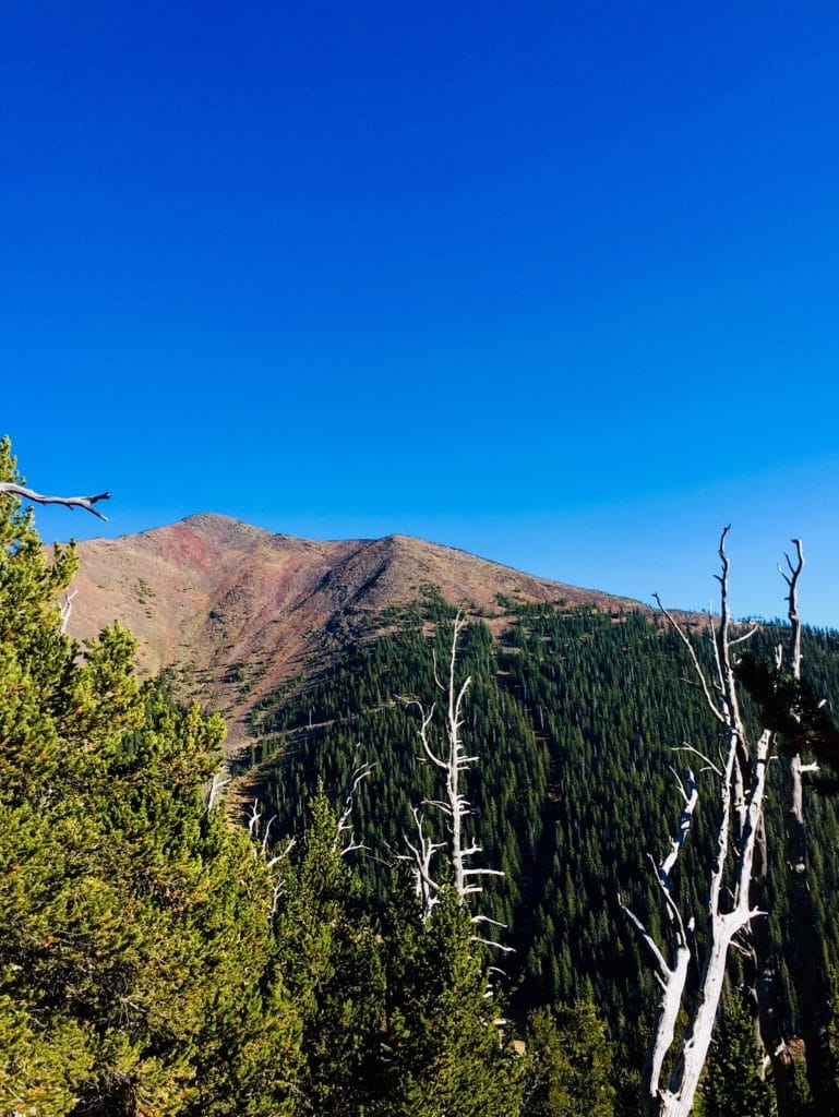
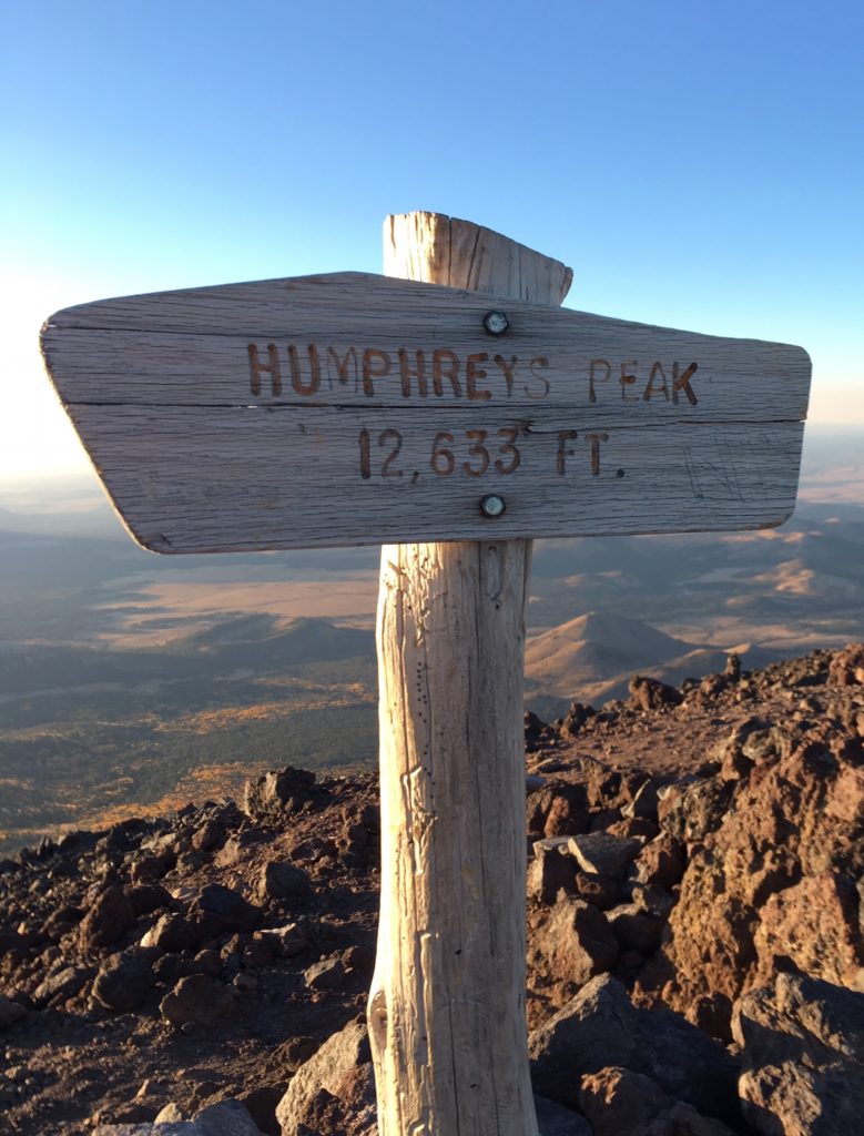
At a cool 12,633 feet, Humphrey’s peak towers above all else for hundreds of miles in any direction. It’s bare, windswept summit entices adventurers from all around to run, hike, and ski it’s slopes. Humphrey’s Peak is so tall that it contains Arizona’s only tiny parcel of Alpine Tundra. The words ‘Tundra’ and ‘Arizona’ are not often found in the same sentence.
Humphreys Peak pokes out at the western side of the San Francisco Peaks. From the summit, an impressive 360 degree view of Northern Arizona stretches out before you. To the north, the white cliffs of the Grand Canyon can be seen. Looking south, Oak Creek canyon carves into Sedona. All around, desert, mountains, and valleys abound.
As the state high point, it may not be as numerically impressive as Colorado’s numerous 14er’s, or California’s Mt. Whitney, but the hike, views, and prominence of Humphrey’s Peak deem it worthy of any hiker looking to bag good peaks.
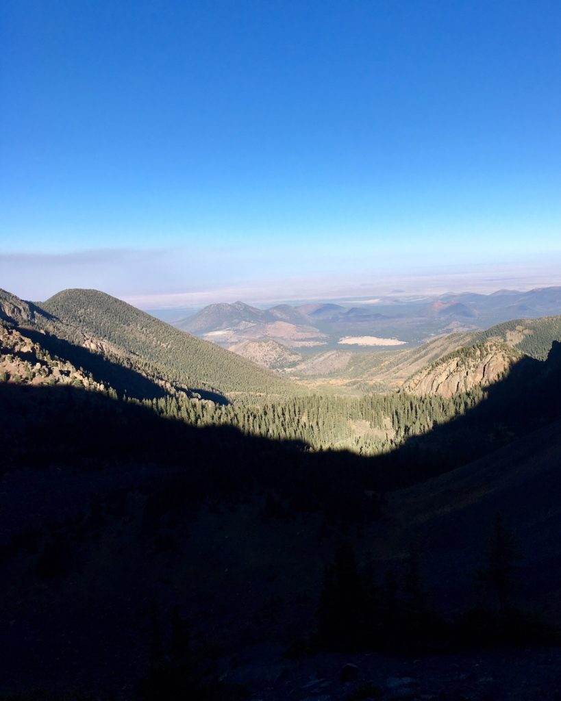
To access Humphrey’s Peak, park your car at the Arizona Snowbowl, and follow the trail across the Hart Prairie ski slopes into the tree line. Here, the forest is thick and lush-a nice departure from the aridity dominating the rest of the state.
The trail switchbacks up the western escarpments of The Peaks, taking the hiker through mixed coniferous forest, as well as scattered Aspen Groves (pro tip: hike this trail in early Fall for some premium leaf peeping!)
At one point, a switchback ends at a large talus field. Depart here to take a side hike to the infamous B-24 Bomber wreckage! After a few miles of switchbacks, you round a corner into a large Glacial Valley. Below you, the ski slopes of the Arizona Snowbowl creep up the mountain.
At roughly the 11,000 foot elevation mark, the thick pine forest gives way to sparser vegetation, marking the beginning of the transition zone to an Alpine climate. At this point, you may begin to feel a strong, cold win, foretelling of the conditions found higher up the mountain.
Upon reaching the Humphreys Saddle (a low point connecting Mt. Humphrey’s and Mt. Agassiz), you are greeted with expansive views down into the Inner Basin. Take a right to start on the Weatherford Trail, and hang a left to proceed to Humphrey’s Peak.
A short mile of scrambling/Hiking past false summits brings you to the top of the peak. Here, the wind and cold is mean enough to cut through normal clothing, so a hardy wind jacket is highly recommended. Trekking Poles are also needed to ensure that the wind does not blow you over.
This is only an abridged description of the Humphrey’s Peak hike. For a more detailed telling, go check out the trail description I wrote over at She Dreams of Alpine. For a longer adventure, there is the option of connecting the Humphrey’s Peak trail with the Weatherford and Kachina trails, creating a backpack-able loop trail.
Distance: 5 miles one way.
Difficulty: Strenuous
Pets?: Yes! But they must be kept on a leash.
Humphrey’s Peak Trail Directions
From Flagstaff, head north on Highway 180. Turn right onto Snowbowl Road, and Park at the Hart Prairie lot. The trail begins once you cross the ski slope.
1. West Fork Trail
Distance: 3.7 miles one way. Further for an overnight trip.
Difficulty: Easy. Watch out when crossing streams.
Pets?: Yes! But they must be kept on a leash.
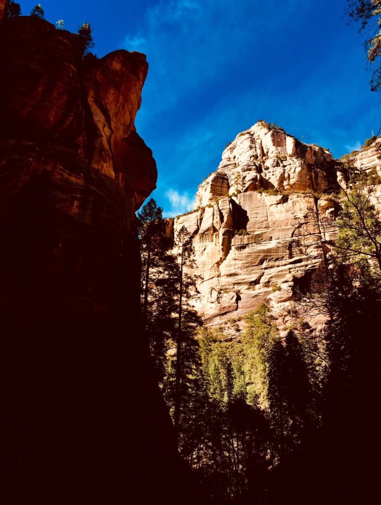
Capping off this list is the West Fork Trail. The West Fork Trail, located in beautiful Oak Creek Canyon, is a large tributary canyon to Oak Creek. The trailhead sits roughly halfway between Flagstaff and Sedona on AZ-89.
Geographically, it’s location made it a toss up for me to group it into either Flagstaff or Sedona. Ultimately, I feel that it belongs to both, and that anyone visiting Flagstaff should go out of their way to hike this spectacular trail.
The West Fork Trail is more akin to the giant slot canyons of Southern Utah than it is to anything else in Arizona. The trail follows a gentle, meandering route through the canyon. Sandstone walls rise hundreds of feet on either side of you, and the canyon bottom is overgrown with lush forest.
Several times, the trail passes through West Fork Creek. Be prepared to get your feet wet, and bring sturdy hiking poles for the slippery crossings.
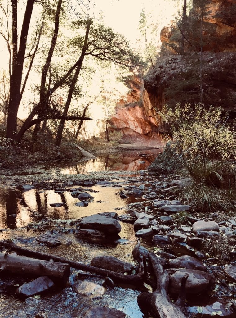
The West Fork Trail is crowded. It sees hikers all year, and for good reason. It is considered by many to be one of the most scenic trails in the United States! For those wishing to avoid the crowds, a better option is to hike longer, and turn it into an overnight excursion.
At the three mile mark, the trail ends. Most hikers turn back, but the canyon continues for several more miles. From here, many parties choose to trek further, camping deep in the canyon.
No matter which method you choose, the West Fork Trail is worth seeing. If you’re spending any amount of time visiting Northern Arizona, the West Fork Trail should be high on your list of destinations.
West Fork Trail Directions
From Flagstaff, drive south on Highway 89. A few miles south of the Oak Creek Canyon switchbacks, turn right into the West Fork Trail parking lot. There is a small fee to park here, unless you have a Red Rock Pass.
Flagstaff Hiking Season
The hiking season in Flagstaff generally starts in mid Spring, and can last well into late Autumn. For those willing to brave the cold, snow shoes, and warm layering can extend the hiking season to year round (see: Our Guide to proper Winter Layering). Generally starting around the 4th of July, monsoon weather rolls into Flagstaff.
The monsoons bring afternoon thunderstorms, and short torrential downpours. When hiking during monsoon season, bring along rain layers. If hiking on a high, exposed point, be wary of lightning, and practice good lightning safety. In 2016, one teen was killed, and two other injured during a summer hike on Mt. Humphrey’s. Flagstaff sees thousands of Lightning strikes every year, and it is only a matter of time before more people are hurt. If any thunderstorms are in the forecast, please be mindful of the risk.
Many would agree that the Fall is the best time to hike in Flagstaff. The temperatures are kind, the weather is fair, the Fall colors are in full bloom. The Southwest is not typically visited for the changing Autumn colors of Deciduous trees. Yet, Flagstaff gives host to several groves of Aspen trees.
In the higher elevations, such as the slopes of the San Francisco Peaks, scattered groves of Aspen can be found. Early October sees the leaves begin to change, creating wonderful displays of color. In peak season, you’d swear that you were in New England.
Flagstaff Camping, Hotels, and Lodging
If you are just visiting for a weekend, there are plenty of options for places to stay. Budget minded as we are, we recommend camping. Camping options abound in Flagstaff. Free dispersed camping can be had off almost every forest road, and there are plenty of established campgrounds available.
When dispersed camping, you will need to pack in your water, and pack out your waste. Most established campgrounds charge a nightly fee for staying in them. For more information on camping in Flagstaff and the Coconino National Forest, please visit the forest service website.
As a tourism based town, Flagstaff has plenty of hotels. In downtown Flagstaff, you have historic hotels, such as the Monte Vista, and the Weatherford Hotel. Along Route 66, there are plenty of motels looking for patrons.
If you prefer a hotel over camping, Flagstaff has you covered. For dining, Flagstaff has plenty of local flavor. For Breakfast, I recommend Martanne’s in downtown.
Camping in and around Flagstaff is abundant, and often cheap or free. Established campgrounds exist, as well as more primitive dispersed camping. To learn more about camping in Flagstaff, check out my article for more detail.
Hiking in Flagstaff: A Few Considerations
Elevation
If you are new to hiking in Flagstaff, there are a few things that make Flagstaff unique to consider before you set out. First, at 7000 feet, Flagstaff’s elevation is pretty high. It is higher than Denver, Albuquerque, and many towns in Colorado.
At this altitude, you will get winded pretty easily. Even after living here for a few years, I still find myself frequently out of breathe. Maybe I’m just a wimp, but expect an adjustment period to the elevations. Often overlooked is the enhanced dehydration factor created by altitude.
The dry desert air, thinned at 7000 feet will suck the moisture right out of you. I find myself drinking upwards of 72 oz. of water per day.
Cultural and Historical Artifacts
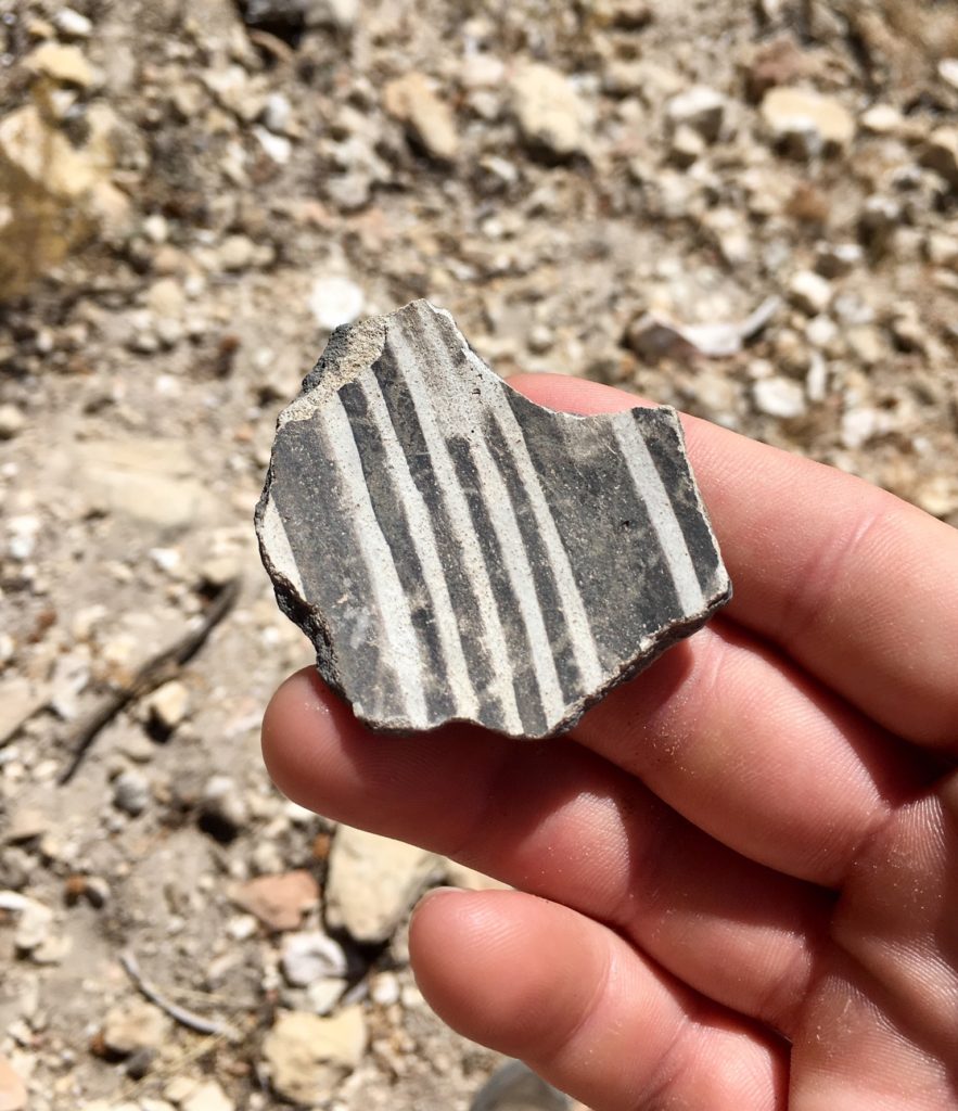
Second, Flagstaff sits in the middle of the largest outdoor museum in the world. In this corner of the country, Native American artifacts-some thousands of years old, are a common find.
If you are out hiking, please do your best to respect any artifacts you stumble across by leaving them be, and admiring only with your eyes. After all, removing, vandalizing, or altering any historical, cultural, or archaeological artifacts is punishable by law.
Long before the arrival of Europeans in the Flagstaff area, it was home to a group of Puebloan Native Americans known as the Sinaguan culture. Here, they built cliff houses into the sides of canyons, settled atop volcanoes, and left many other signs of their occupancy, including broken pottery, and rock art.
You can view much of these remains at local attractions such as Walnut Canyon National Monument, and Wupatki National Monument. These are some of the best places to such artifacts. If you stumble on anything while out hiking, please respect them.
The Flagstaff Area is home to several landmarks considered sacred to modern day tribes throughout the Southwest, including the Navajo, Hopi, and Zuni. Many of these sites are still venerated by these groups. If you encounter a contemporary shrine while out and about, treat it as you would an ancient artifact.
Fire Restrictions
Flagstaff is a dry place, filled with pine trees and shrubbery all highly susceptible to catching fire. If the previous winter was dry enough, the Forest Service sometimes closes large swathes of Coconino National Forest.
Trails, campgrounds, and forest roads are shut off from public access, only to be reopened when mother nature brings more precipitation. Violating these closures can carry a hefty fine.
Though these closings are unfortunate, they are necessary, and rare. They help to protect the forest, and ensures that they remain around for others to enjoy. At the time of this writing, much of the Western United States is in a drought. As such, Forests, National Parks, and our wild lands must be treated with care.
Related: The Toughest Trails in Yosemite National Park
Get The Best Hiking Gear
Flagstaff is full great hiking, with trails ranging from hot, dry desert, to cold Alpine Tundra. Like the Terrain, Weather changes fast around here. After hiking, climbing, scrambling, and mapping all throughout Arizona, we at Hike The Planet! have compiled a list of the Essential Hiking Gear. This is some of our favorite gear, and we’ve handpicked it to help you hit the trail and get hiking with comfort, safety, and style!
- The Best Campsites Around Big Bear California - February 26, 2021
- Hiking to the Hollywood Sign Via the Brush Canyon Trail - July 13, 2020
- Dirt Cheap Hiking and Backpacking Gear: The Most Affordable Gear on the Internet - July 4, 2020
