
Hollywood Sign Hike: Taking the Brush Canyon Trail to a Classic California Monument
Table of Contents
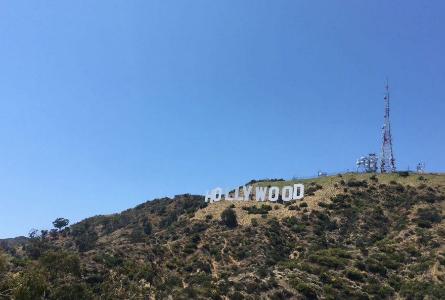
The Hollywood Sign. You’ve seen it. We all have. It’s in our movie theaters, our television screens. The evening news.
The Hollywood Sign is in our dreams.
Big, white letters, hanging high in the sky. An iconic billboard on the pop cultural head of America’s global Hydra. Bow down. Prostrate yourself at it’s altar.
Sorry about the melodrama. I’ll try to keep things lighthearted.
Did you know that you can Hike to the Hollywood Sign? The Brush Canyon Trail, located in Griffith Park, will take you right up to it.
If you’re visiting Los Angeles, hiking to the Hollywood Sign is your chance to get some exercise, and see some great views of the city.
Or, maybe you’re like me-a local that took the Hollywood Sign for granted all of your life. On a boring, summer saturday, you decide to hike up and learn what the hype is all about, and you discover a fun, moderately challenging trail right in the middle of your hometown.
Regardless, check out my guide to the Hollywood Sign via Brush Canyon Trail. You’ll get a detailed write up of the hike, a map, photos, and a brief history of the sign.
Bonus: I’ll clue you in to the Bronson Canyon Batcaves-a classic film and TV location not far from the sign.
Hollywood Sign Hike-Brush Canyon Trail
Easily the most popular hollywood sign hiking trail, Brush Canyon Trail is actually one of three hiking trails that can be used to reach the iconic location. The Mt. Hollywood Trail, beginning at Griffith Park, is the easiest of the three.
The third route-the Cahuenga Peak trail, is more difficult, but provides a more rugged hiking experience.
I’m writing about the Brush Canyon Trail, because I think it is the best way to reach the Hollywood Sign. The whole trail is well marked, and well maintained. Though Brush Canyon is very popular, it can prove to be a decent challenge to novice and moderately fit hikers, all while allowing access to one of the best views in Southern California.
Trail Stats
Location: Hollywood, California
Distance: 5.20 Miles to Tyrolian Tanks, out and back.
Elevation Gain: 580 Feet
Time to Hike: 3 hours, including sightseeing
Best Time of Year to Hike: September-July
Potential Trail Hazards: Rattlesnakes, heat, smog, horse apples, and Los Angeles Traffic.
Brush Canyon Trail Map
How to See the Hollywood Sign (while getting some exercise)
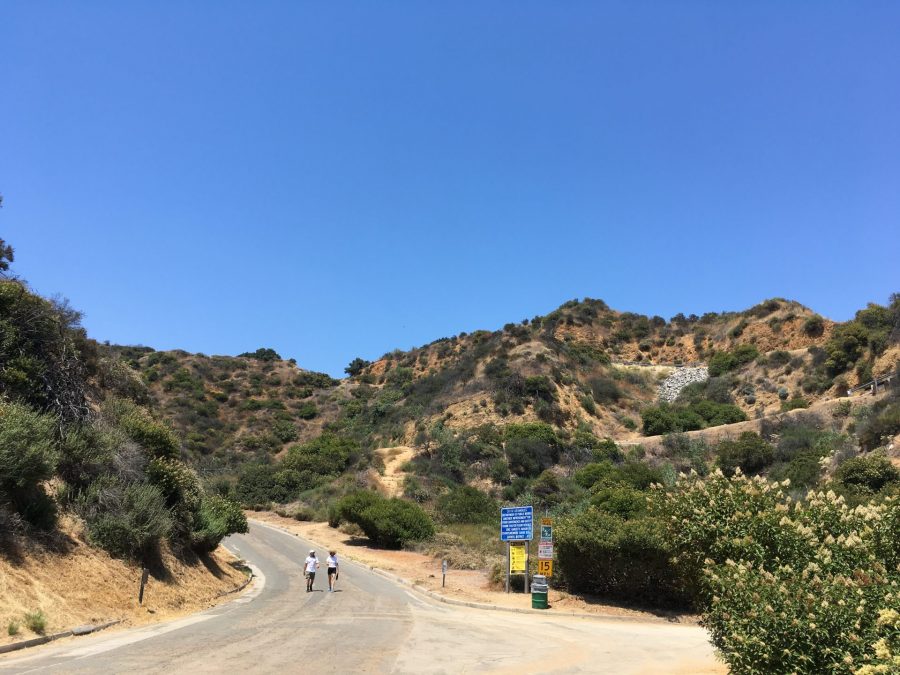
The Brush Canyon Trailhead can be found at the end of Canyon Drive, which can be accessed from Franklin Avenue. A parking lot accommodates visitors, and overflow parking can be found in a dirt lot near the park entrance.
I took my hike on a warm, summer saturday in the midst of the COVID-19 pandemic. Predictably, the park was packed with visitors. A park ranger angled his truck near the entrance, blocking all those who wished to enter. As such, I was forced to park a few blocks down Canyon Drive. Walking past all of the upscale, swanky Hollywood homes, I felt underdressed in my hiking clothes, and worn Trail Runners.
Surrounding the start of Brush Canyon Trail are several grassy parks, complete with playgrounds, BBQ pits, and picnic tables. A seasonal stream runs here, and several tree species provide shade. This is typical California Riparian habitat, where trees with deep roots survive off of the seasonal stream.
As soon as the trail begins it’s ascent towards the Hollywood sign, hikers will quickly lose the shade. If it’s a warm day, feel free to take a moment to enjoy the cool grass before you begin climbing.
The hike doesn’t officially begin until you’re well into the bounds of the park. A sign displaying a map of the area, and a locked gate mark the start. A short walk to the southeast takes you to Bronson Canyon, but hikers continuing to the sign must proceed straight. Bronson Canyon is cool, but I’ll get to that shortly.
Hikers, Horses, and Hollywood Homes
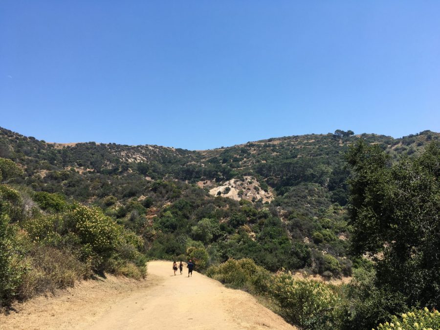
As you begin to hike out of the bottom of Brush Canyon, the environment noticeably changes. The Oaks and Sycamore Trees give way to scrubby, California Chaparral Habitat. Red Tail Hawks can be seen flying overhead, and you there’s a good chance that you might spot a rabbit, or deer.
You might notice that the “trail” is more like a well paved dirt road. It follows a gentle, yet persistent incline for much of the hike, climbing more than 600 feet to your destination.
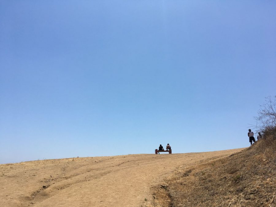
With plenty of well placed amenities along the way, this may just be the most user friendly trail in the whole city. Trash Cans can be found at regular intervals, and benches have been placed at the best overlooks. The whole trail is very well maintained, and is wide enough for most groups to spread out, and observe social distancing guidelines.
The Tyrolian Tanks are your main destination, though I made a couple of rad detours during my hike. To get to the Tyrolian Tanks, simply follow the trail/dirt road as it cuts along the hillside, going west. There will be several side trails that split off, but stay the course on Brush Canyon.
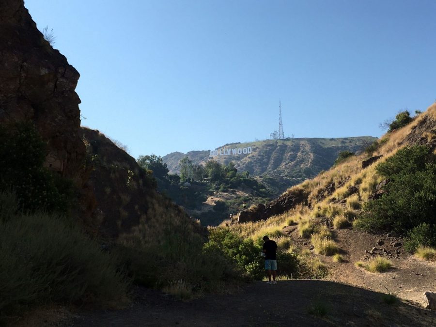
When in doubt, look to the west to see the tall communications towers. The Hollywood sign lies just below them, facing south.
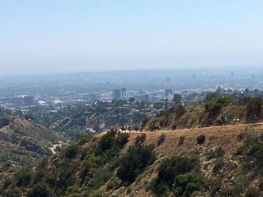
Don’t hike the Brush Canyon Trail for solitude. For sheer popularity, this trail rivals any of the most popular walking paths in Yosemite, if not the entire National Park system. You’ll be sharing the trail with not only hikers, but joggers, and equestrians.
When I visited on a warm Saturday, there were hundreds of people making their way up and down Brush Canyon. Families, Tourists, and even rustic horseback tours, courtesy of Sunset Ranch, were sharing the trail, and enjoying the views.
In a mega metropolis like Los Angeles, there is hardly a time where a hike to the Hollywood Sign wouldn’t be crowded. If you want to minimize the amount of people that you’ll be sharing the trail with, either time your hike for the early morning, during the winter slow season, or on a weekday.
Tyrolian Tanks
Though the Brush Canyon Trail branches off to other paths, my GPX track concludes at the Tyrolian Tanks. Why? Because I was following the posted trail signs, like a good little hiker.
Of all the spots to get a frontal view of the Hollywood Sign, the Tyrolian Tanks are probably the best. The Tanks sit at a wide, flat dirt area, where one can spot the Hollywood Sign hanging in the sky above.
A very popular spot, I was one of several dozen people hanging about at the Tyrolian Tanks, and half of them were posing for Instagram pictures.
Spend enough bored days in LA, swiping through dating apps, and you’ll see that plenty of users like to pose with the Hollywood Sign. It seems to be a rite, of sorts.
If you’re hiking on a hot day, you’ll find some welcome shade beneath some pine trees. I took the opportunity to call some friends, and enjoy the view of both the sign, and the whole city. Looking south, all of Hollywood, as well as downtown Los Angeles are in full view.
On a summer evening’s golden hour, this could be the most inspiring view in the whole city. Just don’t venture too far down into the residential neighborhood directly to the south. The residents don’t always approve of hikers crowding their neighborhood.
How to Get to the Back of the Hollywood Sign
Though the view from the Tyrolian Tanks is great, even better viewing spots can be found nearby. Take the time to hike a little further, though, and you’ll find yourself at a great view from the back of the Hollywood Sign.
About 3/4s of the way up Brush Canyon Trail, you probably noticed that the trail splits off to the right, and follows a paved road higher up the mountain. Track back to this fork in the road, and follow the road.
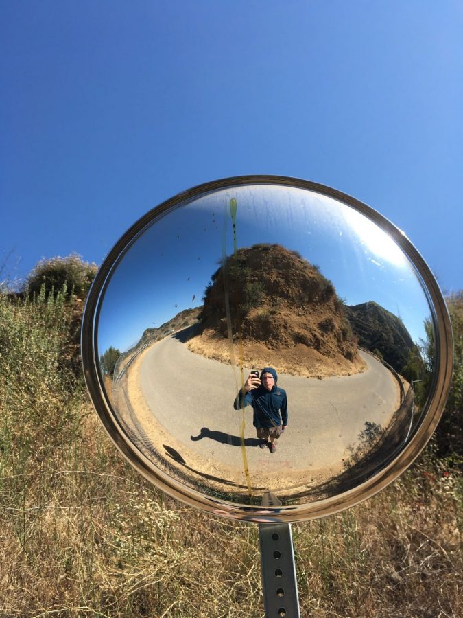
This road quickly steepens, tracking along hairpin turns. To my amateurish photographic eye, these hairpins made for some cool photo ops. You’ll even find some cool concave mirrors (in which I snapped some vainglorious selfies).
Anyways, hiking to the back of the Hollywood Sign only adds another 1/4 mile (or so) hiking distance, and a few hundred feet of elevation gain. It adds a little more challenge to your hike, and the payoff is an incredible view.
The road winds around the ridge, providing a great view of the San Fernando Valley, Burbank, Glendale, and the San Gabriel Mountains. On a clear day, you can see all the way to the Pacific Ocean.
You can tell it’s Burbank, because the blue and yellow brand colors of the Burbank Ikea store stick out like a sore, Swedish thumb. But I digress.
The road you’re on keeps climbing, with the occasional oak tree providing shade. Before curving back towards the summit destination, you’ll come to a small ridge with a trail leading to Cahuenga Peak. Cahuenga Peak is one of the more recent additions to Griffith Park, and stands as the highest point in the whole park. If you’re looking for a more challenging path to the Hollywood Sign, you can read more about the Cahuenga Peak Trail here.
The View from the Hollywood Sign
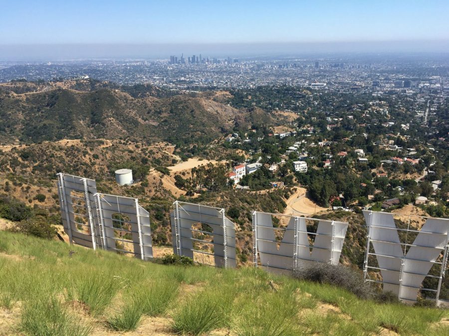
Your destination lies in just one more turn in the road. The path ends at a locked, barbed wire fence surrounding the communication towers atop Mt. Lee. To your right, just down the hill side, lies the Hollywood Sign. For the average hiker, this is about as close as you’ll ever get to the sign, without being Lana Del Rey.
The view is stunning. The sprawl of Los Angeles is framed to you in H-O-L-L-Y-W-O-O-D. If you’ve ever searched for the view from the Hollywood Sign this is it. I reached the summit of Mt. Lee during the middle of the day, when the sun was still high.
My suggestion is to time your hike to reach the summit when the sun is setting. The smog of Los Angeles has a way of catching the setting sunlight, and casting it into a beautiful amber glow. The photos you take here will be the perfect addition to your end of year holiday cards.
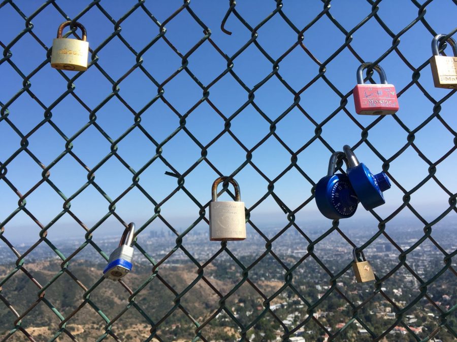
Bonus Tip: Got a spare padlock? Go ahead and fix it to the fence above the sign. Hundreds of other people did. Normally, I’d caution against such a blatant disregard for LNT Principles. At a place like the Hollywood Sign, though, I’d say it’s alright.
Tips for Hiking the Hollywood Sign
Hiking on Brush Canyon Trail is fairly straightforward. That said, here are some tips to help you make the most of your hike.
- Bring Water-Once you begin your hike, there are few places (if any) places to fill up water bottles, or to take a drink. Brink at least 2 Liters of water per person, and 3 Liters if you are hiking on a hot summer day.
- Wildlife-Wildlife is present, and common in the park. Do not feed, approach, or otherwise interact with wild animals beyond taking pictures.
- Rattlesnakes-Rattlesnakes are present in Griffith Park. They are most commonly seen in the spring, summer, and fall, and can be found resting in the shade under logs and rocks, or sunning themselves in a flat, open area. Avoid walking in areas with tall grass, do not stick your hands or feet in places where you can’t see them, and be mindful of children and pets playing in bushes and grass. If you see or hear a rattlesnake, get away from it immediately. If you are bitten, dial 911.
- Social Distancing-To reduce the spread of COVID-19, and to ensure that public outdoor areas like Griffith Park remain open, do your best to socially distance yourself from others. The trails are wide enough to maintain six feet between each hiker, and I recommend bringing a face mask.
- Parking-On popular days, parking at the Trailhead fills up quickly. If it is full, you can park along the street on Canyon Drive. Be careful not to block driveways, fire hydrants, or park in red zones. To do so would be disrespectful to the local residents, and could jeopardize access to the trail.
- Do not trespass near the Hollywood Sign-The Hollywood Sign is closed off for a reason. Trespassing to get up close, or climb on the Hollywood Sign will net you a hefty fine payable to the city of Los Angeles.
- Enjoy Everything Else that Griffith Park Has to Offer-Besides the Hollywood Sign, good hiking trails, the Griffith Observatory, Bronson Canyon, and the LA Zoo are all just a stone’s throw away. You can easily combine your hike with any of these attractions to make a full day.
Bonus-Bronson Canyon and the Bat Caves
On your hike to the Hollywood Sign, I highly recommend taking a short detour to check out Bronson Canyon.
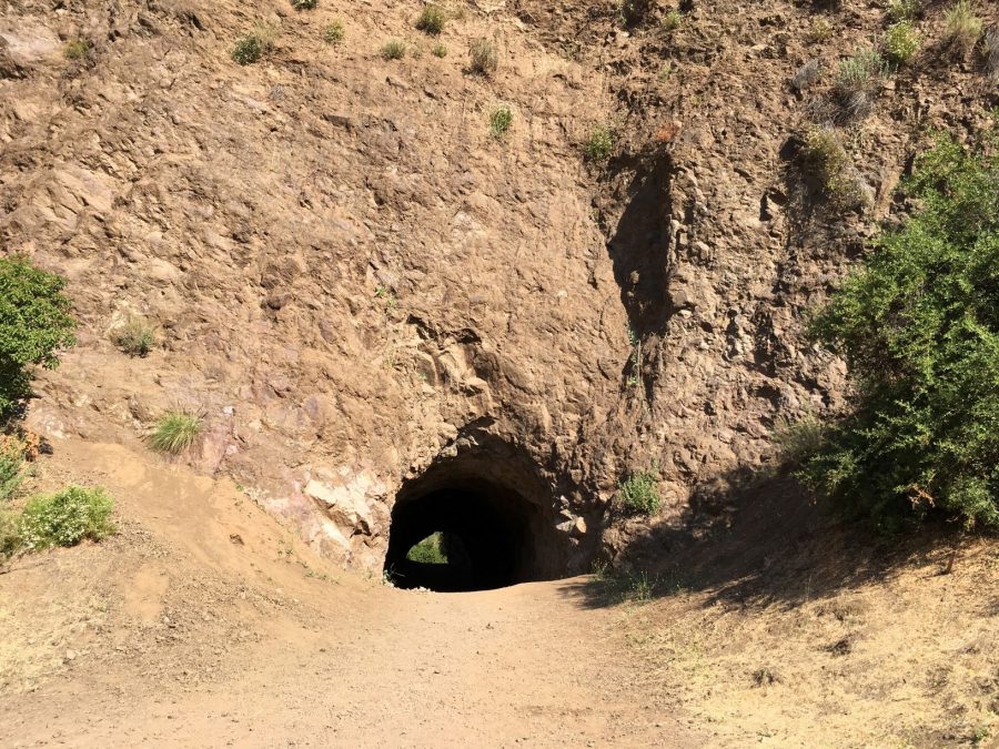
A small canyon lined with steep, rocky cliffs, Bronson Canyon is best known for its iconic cave. About 100 feet long, and large enough to drive a truck through, the Bronson Canyon Cave is a local oddity.
Bronson Canyon began as a quarry, supplying stone to build city streets. After mining operations ceased in the 1920’s, the site fell under the purview of the local movie and television studios.
Much like nearby Vasquez Rocks, Bronson Canyon became the local de facto outdoor film set. Anytime a shoot called for an alien planet, wild west scene, or craggy, desert environment, Bronson Canyon was just a short drive away.
Classic Television fans may best recognize the Bronson Canyon Cave system from the 1960’s Batman TV series. Serving as the location of Batman’s bat cave, Batman and Robin (as portrayed by Adam West and Burt Ward) could be seen in the batmobile, driving out of the Bronson caves at full speed.
Other notable productions include The Searchers (1953), and Star Trek: Voyager. Bronson Canyon eventually fell into disuse by the Studios. Griffith Park took it over, and now hikers, joggers, and even rock climbers are the primary user groups of the caves.
There’s a prime view of the Hollywood Sign from Bronson Canyon. Framed by the canyon walls, this view of the Hollywood Sign rivals the Tyrolian Tanks viewing area. If all the people posing and taking pictures are an indication, then it must also be a great photo op.
Directions to Brush Canyon Trail and the Hollywood Sign
Though it may be a giant, glaring, unmistakable landmark, actually making your way up close to the sign is a little tricky. The information available on the internet is conflicting, and misleading. Very often, people in search of the sign find themselves making wrong turns, getting lost, or find that the “viewing” spot they were sent to is no longer open to the public.
Don’t worry. It’s not your navigational skills that are messed up. Blame the residents of Beachwood Canyon, and the Hollywoodland neighborhoods.
Tired of the throngs of tourists crowding the narrow, suburban streets, trespassing, and making a mess, the denizens of the local neighborhoods sought to curb the impact.
Enlisting the help of Big Data, they turned to daddy Google. The residents successfully petitioned the tech giant to reroute tourists away from their homes, instead directing them to spots far away from the actual sign.
For example, googling “Hollywood Sign Directions” directed me to the Griffith Observatory. Though close by, the sign is not visible from the Observatory. A long (but easy) hike is required to reach the sign from the Observatory, but is far less direct than traveling to the Brush Canyon trailhead.
Instead, here are some turn by turn directions to Brush Canyon Trailhead. These directions assume that you are travelling from the 101 freeway.
- Take the 101 Freeway to Hollywood, Exit Gower Street (Exit 8c). Head North on Gower.
- Make a Quick Right on Franklin Avenue. Continue for .3 Miles
- Turn Left on Brush Canyon Trail. Continue 1.2 Miles to the first Parking Lot.
One you park, follow the road further north into Griffith Park. The start of the Brush Canyon Trailhead begins with a locked gate, and a posted map.
A Brief History of the Hollywood Sign
Contrary to popular belief, the Hollywood Sign wasn’t always there. It’s history can’t be summed up as a chicken-or-the-egg conundrum. Get that notion out of your mind.
The government agent standing behind me wants you to know that the Hollywood sign wasn’t constructed by ancient extraterrestrials, either. Nope. Definitely not.
Instead the story of the Hollywood Sign begins way back in 1923, about halfway between the Spanish Flu pandemic, and the Great Depression. It used to read ‘Hollywoodland’, first built as a temporary real estate advertisement for the burgeoning city. The peak that holds the sign-Mt.Lee, was named for one Don Lee, an early Los Angeles radio broadcaster and entrepreneur. That would explain the towers.
The ‘Land’ part was eventually dropped, to better represent the whole city, rather than just the housing development at the foot of the hill. Over the decades, the Hollywood Sign fell into disrepair, it’s flimsy white letters exposed to LA’s pleasant climate. At one point, it is said, the sign’s drunk caretaker drove his car into the letter H, destroying it.
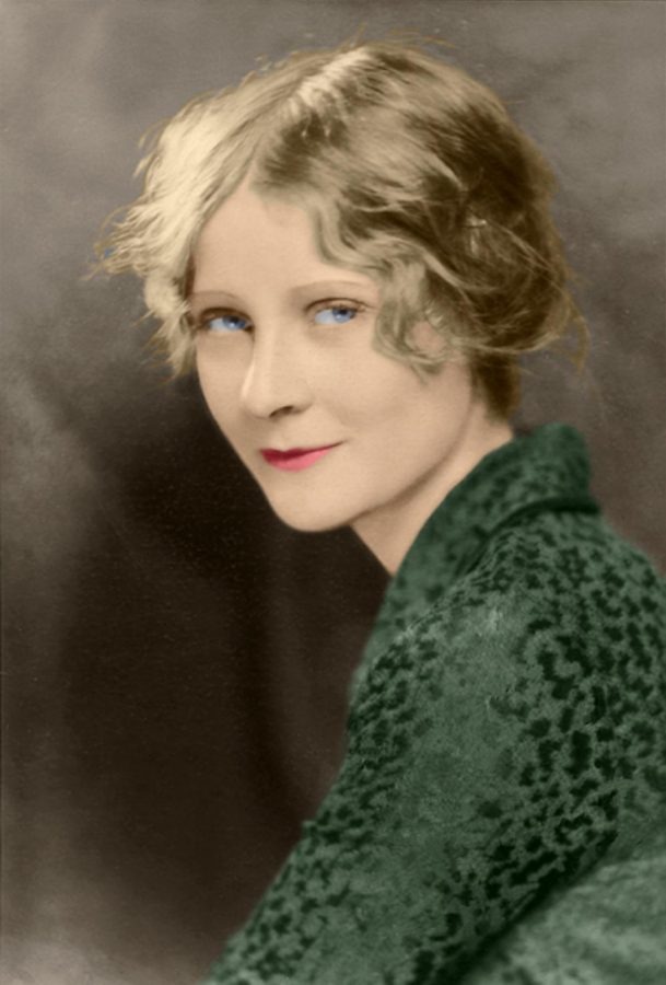
Perhaps the most infamous incident involving the sign took place in 1932, during Hollywood’s Golden Age. Peg Entwistle, an up and coming English stage actress, had made it to Hollywood to become a starlet of the silver screen. Tragically, the young actress took her own life by jumping off of the letter H. Her death is probably the reason why the sign is fenced off from public access.
Oh, and there was the Hollyweed Incident. Back in 2017, some pranksters saw fit to crack a joke at the sign’s expense. I didn’t mind. In fact, I hardly noticed.
In the intervening years, the Hollywood Sign became the sight of numerous television and movie productions. The sign rivals the Golden Gate Bridge as California’s most iconic landmark, having been seared into minds the world over by the vast reach of American pop culture.
Griffith Park
The Hollywood Sign sits atop Griffith Park-LA’s premier urban park. Separating the San Fernando Valley from the Los Angeles Basin, Griffith Park represents the eastern end of the Santa Monica Mountains.
Griffith Park can be seen from all over the Los Angeles area, a massif sharply rising above the urban landscape. Comprising 4,210 acres, and with elevations ranging between 384, and 1,625 feet, Griffith Park is pretty large. Among Griffiths hills and canyons, a whole network of trails, picnic areas, museums, abandoned zoos, celebrity homes, and not so abandoned zoos exists. Griffith Park has plenty of attractions, and is chock full of history.
The Park is large enough, in fact, to harbor it’s own wilderness area. Thoughtfully preserved in Griffith is a healthy California Mediterannean ecosystem. Sagebrush and Chaparral cover the hills, while oaks and cottonwoods fill its canyons. Despite being located in the middle of a huge city, wildlife is flourishing in Griffith Park.
Deer, Coyote, Redtail Hawks, and even a photogenic Mountain Lion, call Griffith Park home. The park’s ecosystem has adapted itself to the huge human present. Mice and rabbits nibble at dropped energy bars, while coyotes raid the hillside neighborhoods. It warms the heart knowing that, as huge and gridlocked LA is, the animals sleep soundly in Griffith Park.
Other Cool Things to Do in Los Angeles
The Hollywood Sign is a worthy addition to any Los Angeles visit, but there are plenty of other cool things to do while you’re here. Here are a few recommendations, from a local:
Go On More Hikes!
I’m biased here, because hiking is something I do all of the time. There are some great hiking trails very close to the city of Los Angeles. The San Gabriel Mountains, located to the East of the city, is a great area to enjoy some hikes, and experience the great outdoors.
Santa Clarita, a quiet suburb north of Los Angeles, features some awesome, less popular hikes that you can check out.
Visit Joshua Tree National Park

A two hour drive out into the desert lands you in Joshua Tree National Park. Known for its unique Mojave ecosystem, and surreal rock formations, Joshua Tree is a popular spot for outdoor lovers. Hikers, Rock Climbers, and Influencers flock to Joshua Tree in droves, searching out it’s beautiful vistas, and unique challenges. Just a short day trip from LA, this National PArk is worth a visit.
Check Out the Griffith Observatory
Perched on a hillside, and just a short distance from the Hollywood Sign is the Griffith Observatory. This free, public museum features educational and entertaining scientific exhibits, as well as night time telescope viewings. You might recognize the Griffith Observatory as the filming locations of such classic films as Rebel Without a Cause, and Terminator To view through the telescopes, I suggest arriving on a clear night, and getting in line early.
Conclusion-Why the Hollywood Sign?
Los Angeles is chock full of awesome hikes. If you’re looking for a fun, moderate Hike with great views of the city, look no further than the Hollywood Sign. The trail is perfect for hikers of all skill levels and ages, and there are plenty of other cool and interesting things to do nearby. The chance to hike to the Hollywood Sign, a world famous monument, should not be passed up.
- The Best Campsites Around Big Bear California - February 26, 2021
- Hiking to the Hollywood Sign Via the Brush Canyon Trail - July 13, 2020
- Dirt Cheap Hiking and Backpacking Gear: The Most Affordable Gear on the Internet - July 4, 2020
2 thoughts on “Hiking to the Hollywood Sign Via the Brush Canyon Trail”
Comments are closed.