Hiking The Four Mile Trail in Yosemite National Park
Yosemite Valley’s Four Mile Trail finds its way up the path of least resistance. Sheer walls are the defining feature of Yosemite, but the Four Mile Trail, by hook or by crook, will get you up above the rim. It’s not an easy trail, but it’s certainly not the most difficult.
And what is more, the payoff for all of your effort is a visit to Glacier Point–the grandest lookout point this side of the Prime Meridian.
There is no better way to reach Glacier Point than by hiking your behind off attempting to get up a tough trail. Your ascent of the Four Mile Trail yields powerful views of Yosemite’s numerous mountains, meadows, and waterfalls.
The Four Mile Trail is ideal for hikers looking to push their limits. This is for the hiker who has made moderate gains in fitness and experience, and now wishes to climb into a more elite level. Motivations aside, this trail is also great for any hiker wishing to break a sweat, and soak in some of the best views of Yosemite Valley.
Stats and Figures and Things
Table of Contents
Distance: 4.6 Miles (not Four Miles)
Elevation Gain: 2,800 feet, from the Valley Floor to Glacier Point
Difficulty: Strenuous, albeit the easiest of Yosemite’s tough hikes
Best Time to Hike: Summer, until the Winter’s first snows.
Duration: Allow 4 hours, out and back. More, if you want to hang out at Glacier Point, or connect with nearby trails.
Directions to Trailhead: Park at the Four Mile Trail Trailhead, located west of the swinging bridge parking area, or take the El Capitan Shuttle (recommended during the busy season)
Dogs Allowed?: Nope. No Way.
Should I Bring My Bluetooth Speaker?: No. Throw that thing in a bear proof dumpster.
Four Mile Trail Map
The Four Mile Trail-What To Expect
The name Four Mile, is a misnomer. This name better suits a rags to riches hip hop biopic. In reality, to get from the Valley to Glacier Point, your mileage will just tip over 4.6 miles.
Who is going to hike only 4 miles, and turn around? Probably no one. It is more accurate to say that the first four miles are the challenging part, and that the creators of the trail were actually not that creative.
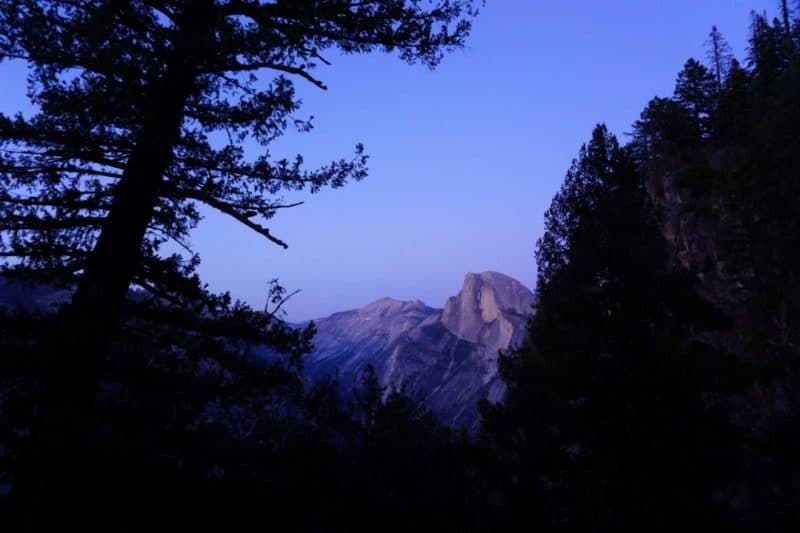
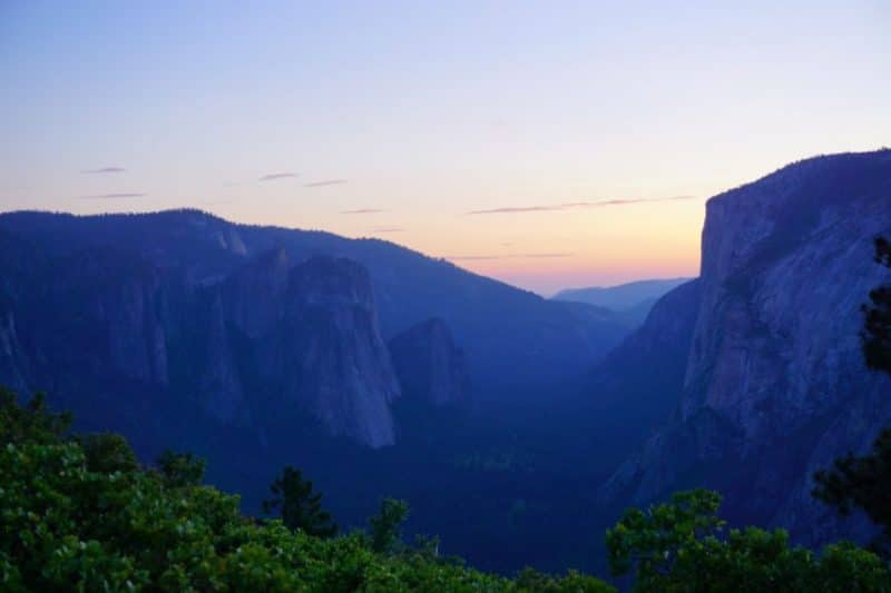
The Four Mile Trail climbs through multiple Yosemite environments. As a result, the scenery along the trail constantly changes, ensuring that you won’t get bored. I hiked this trail twice-once in the middle of the day, and another time in the early evening. You’ll see pictures from different times of day.
Fun Fact: The Obamas once Hiked the Four Mile Trail. Now that’s a Former U.S. President that I wouldn’t mind hiking with.
Tip Toe Through The Talus
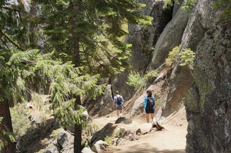
Right off the bat, the Four Mile Trail begins it’s steep ascent. Hikers begin switchbacking through a big Talus Pile. Talus (a.k.a Scree) seems to be a requisite feature of any trail in Yosemite Valley. I guess that should be obvious when there are big cliffs all around, and gravity is always trying to coerce rock off of the walls.
Talus, unlike the pile of dirty socks in your bedroom, is not just useless detritus. In Yosemite, rock piles form an important part of the valley ecosystem. All sorts of wild animals, like raccoons, bears, and rock climbers, make their homes amid the boulders.
Shady aspects harbor verdant oak woodlands, while lichens and mosses begin to breakdown the rock into soil. Hikers will find Talus to be a convenient ramp to gain new heights, just as the pioneers of the Four Mile Trail did.
Lookin’ Good, Half Dome
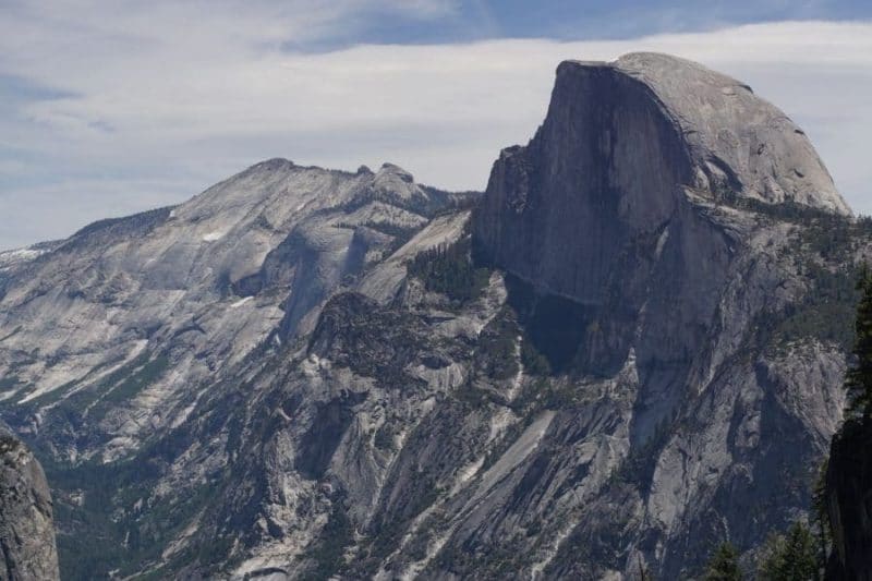
Looking at Half Dome never gets old. Though it is ever present, dominating the Yosemite skyline like the Goodyear Blimp above a Baseball game, I still catch myself staring.
There are very few valley hikes where Half Dome is not always there, hanging out in the background. Staunch and strong and so beautiful. Half Dome, you are my rock in this sea of tourists.
The Four Mile Trail affords some of the best views of Half Dome in all of the valley. Halfway up the hike, during the second set of switchbacks, you will find the best vantage points to sneak a peek. Here is where I stopped to chomp down on some baby carrots, when all of a sudden, there’s Tis-Sa-Ack, hogging the limelight once more.
Just in case you were fretting that all you had was boring old El Capitan to stare at, Half Dome’s iconic Northwest Face is right there, presented for your gazing pleasure. This view is like the one from the valley floor, but better.
Just north of Half Dome, Tenaya Canyon troughs northward to the Yosemite high country. According to legend, Tenaya Canyon is cursed. Yeah, cursed to look really pretty and picturesque. Spooky.
Union Point
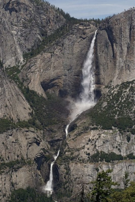
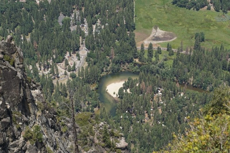
At about the 3 mile point, a short side trail splits off to Union Point. The views along the Four Mile Trail are epic, for sure. At Union Point, they’re all packaged together into a pretty panorama.
Peering towards the valley floor, the meandering path of the Merced River guides your eye away from the miles of traffic choked roads. That big blue rectangle is the pool at the Yosemite Valley Lodge. Just beyond is the trail to Upper Yosemite Falls.
Speaking of Yosemite Falls, you get a nice view of the whole shebang. Both the Upper, and Lower are laid bare, like the frog dissection project in your 9th grade Biology class.
Union Point is another good spot to rest in preparation of the final push to Glacier Point. You can stretch, take silly photos, take serious photos, eat a snack, chug a gallon of milk, etc. Anything you need to do, really.
I recommend stopping here, at least to say that you did. After Union Point, you’ve got nothing but switchbacks in store.
At Union, I ran into a European Hiker. He was low on water, so I offered to fill him up. I’m assuming that, in broken English, he thanked me. Or maybe he insulted me. Either way, I hope to be blessed with good trail karma from here on out.
Sentinel Rock-A Monumental Progress Metric
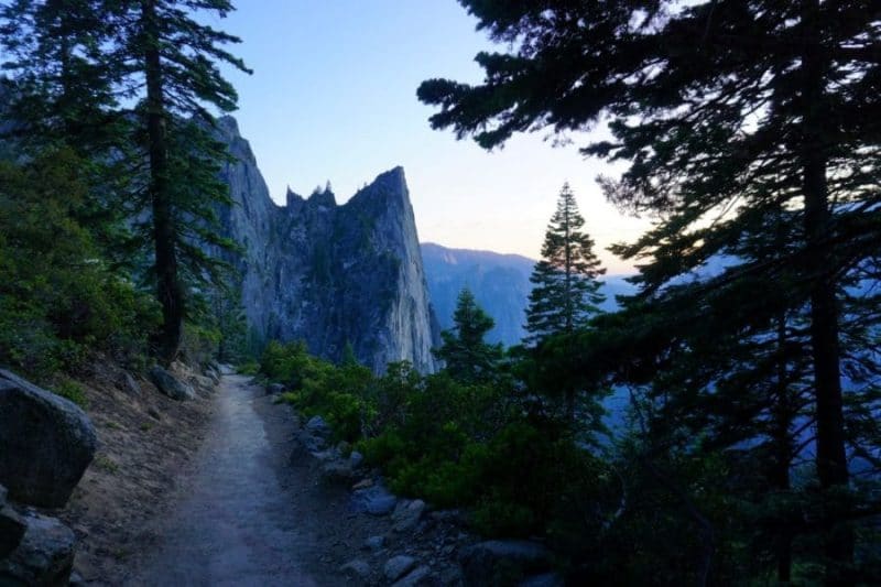
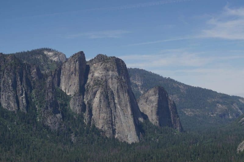
The Four (point six) Mile Trail creeps up the broken cliffs and forest directly east of Sentinel Rock. Not to be confused with nearby Sentinel Dome, Sentinel Rock is a big, grey tombstone shaped cliff. It’s almost monolith like. Some might say it was placed there by Ancient Aliens. Others may even be compelled to begin worshipping it. All hail the monolith.
More likely, it’s shape was formed via natural weathering. Regardless of Sentinel’s creation story, that rock has gained some notoriety. Ansel Adams once photographed it, and it’s angular, sheer flanks tout some of Yosemite’s most famous Rock Climbs. But for the hiker on the Four Mile Trail. Sentinel Rock will be a handy yardstick to judge your progress. When Sentinel Rock is looming high above you, you still have a lot of hiking ahead. When you find that you are looking down on Sentinel’s lofty peak, then the end of the trail is near.
To Glacier Point (And Beyond?)
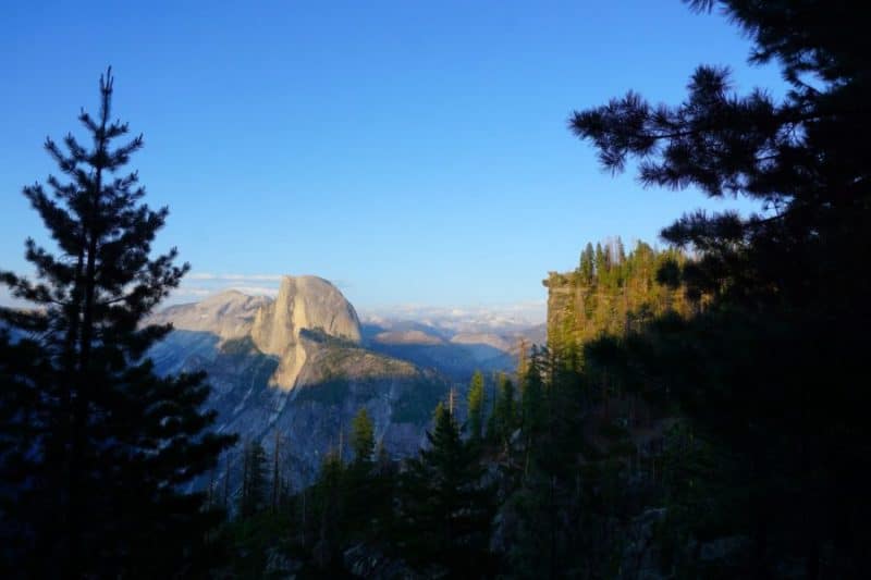
After all of the thousands of feet you’ve climbed, the trail finally levels out a bit. “Finally” you express, pushed through labored breathing. This is the last stretch, and it is flat, friendly, and shady. It won’t be long before you’re chowing down on Ice Cream while enjoying Glacier Point’s world class views.
The Four(point six) Mile Trail is easily connected with other trails. Glacier Point is a junction point of Yosemite destinations. If you want to make a whole day of it, add the Taft Point, Sentinel Dome, or the longer, slower burning Panorama Trail, onto your itinerary.
You have just conquered this hike, but maybe your newfound victory is feeling a bit Pyrrhic (I’ve always wanted to use that word). Chances are, you want to hike down, not up. The goal now it to end up back in the loving fold of the Valley Floor, with its traffic and abundant dining options.
Barring hitchhiking, hiking back down is your only option. Turning around, and hiking back down the Four Mile Trail will be fastest, but the Panorama Trail will be new, exciting, and all downhill. You even get to see Vernal and Nevada Falls too!
Need Gear?
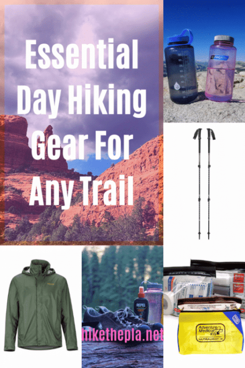
The Four Mile Trail comprises one of the Valley’s more demanding hikes. With switchback after unrelenting switchback, and little shade to rest your aching feet, you’re going to need the best hiking gear for the job. We’ve (read: me) curated a list of Our Favorite Hiking Gear. We want to help you have a safe and enjoyable time while hiking in this beautiful place.
- The Best Campsites Around Big Bear California - February 26, 2021
- Hiking to the Hollywood Sign Via the Brush Canyon Trail - July 13, 2020
- Dirt Cheap Hiking and Backpacking Gear: The Most Affordable Gear on the Internet - July 4, 2020
