Hiking Whitney and Elsmere Canyons in Santa Clarita, California
Table of Contents
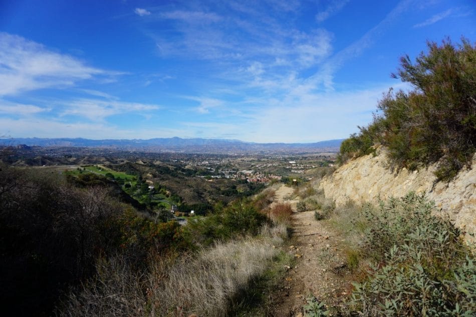
Sandstone buttresses, unlike anything else in town, stand over Highway 14. Across the way from the Cemetery, these cliffs always caught my eye as something to look at when caught in rush hour traffic. A headwall that might have been fit for a rock climber, complete with caves and overhangs. For years, I always wondered what a hiker could find perched on those cliffs.
Born and raised in Santa Clarita, I’ve searched every nook and cranny for the best outdoor spots. By now, I’d thought that I had sniffed everything out. That is until I trekked into Whitney and Elsmere Canyons.
Whitney and Elsmere Canyons are two links in a chain of canyons that line the southern borders of the Santa Clarita Valley. Like nearby Placerita and Towsley Canyons, Whitney and Elsmere Canyon provide variety and substance in a uniquely californian Landscape. Together, these two canyons should not be missed by any local hiker.
All of the Hiking trails begin at a park and ride area, located just off of Highway 14, at the Newhall Avenue exit. Facing the canyons, with the freeway at your back, Whitney Canyon covers the trails to the left, while Elsmere encompasses the trails to the right.
Related: The Best Hiking Trails in Santa Clarita, California
Geology
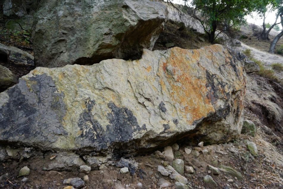
Of all the hiking areas in Santa Clarita, Whitney and Elsmere Canyons provide the most interesting examples of local geology. Both of these Canyons are created by the uplift of several geologic formations, including the Pico, Towsley, and Saugus Formations.
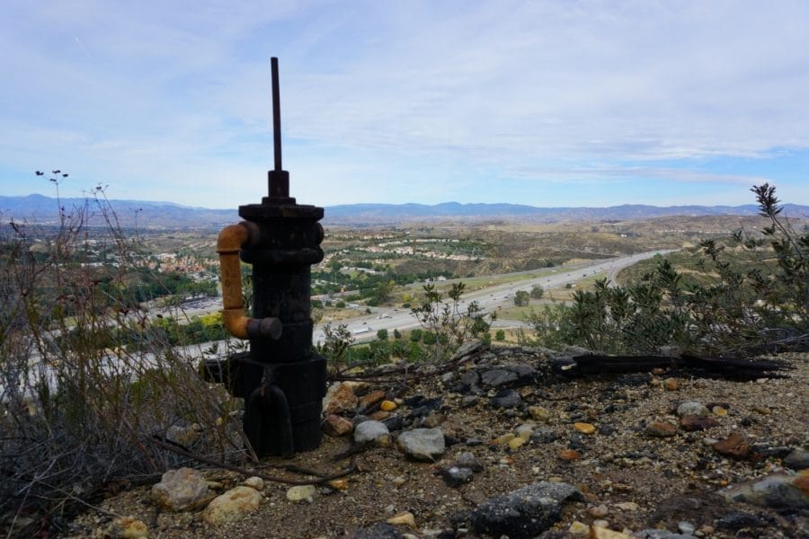
Black tar seeps from Elsmere’s Canyon Walls. The sticky, black residue is a testament to the area’s productive oil beds. A long history of Oil extraction colors the Santa Clarita Valley. Signs of an oil boom are all around-evident not only in the tar, but in the rusting machinery that peppers these hills.
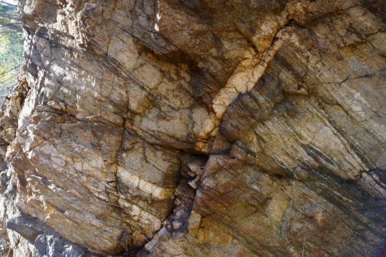
Both of these Canyons are bisected by the Whitney Canyon Fault. As one hikes further into the canyon, seismic uplift becomes more apparent. The rock types abruptly change from loose sediment to hard, fine grained gneiss.
This black and white banded rock is part of the basement rocks forming the San Gabriel Mountains. Resembling granite, Gneiss is a metamorphic rock formed by extreme temperatures and pressure deep below the earth’s crust. Basement Gneiss forms the slick cascades of upper Whitney Canyon, for example.
Directions to Whitney and Elsmere Canyons
Both the trailheads to both Whitney and Elsmere begin at a Park and Ride just off the Newhall Avenue exit on Highway 14. Easily accessed, Santa Clarita residents can reach the trailhead by taking Newhall Avenue south to it’s terminus, just past the 14 freeway.
If coming from the San Fernando or Antelope Valleys, take the 14 to Santa Clarita. Exit at Newhall Avenue, and drive to the parking lot, located just next to the freeway exit.
Whitney Canyon
Mt. Whitney is the Highest Peak in the lower 48 states. At 14,505 feet, Mt. Whitney towers over the landscape, and sees thousands of hikers and climbers each season.
Uh wait…my bad. Wrong Whitney.
Whitney Canyon (no relation to the more famous, beautiful, and impressive Mt. Whitney) is a cool canyon with lots of sweet hiking trails!
Between Placerita Canyon, and Elsmere Canyons lies Whitney Canyon. Several trails allow hikers to explore the area. The easiest (and most interesting) trail hikes up to the end of Whitney Canyon as it narrows into a stony gorge. Other trails follow service roads as they climb up into the surrounding hills, allowing great views of the Santa Clarita Valley.
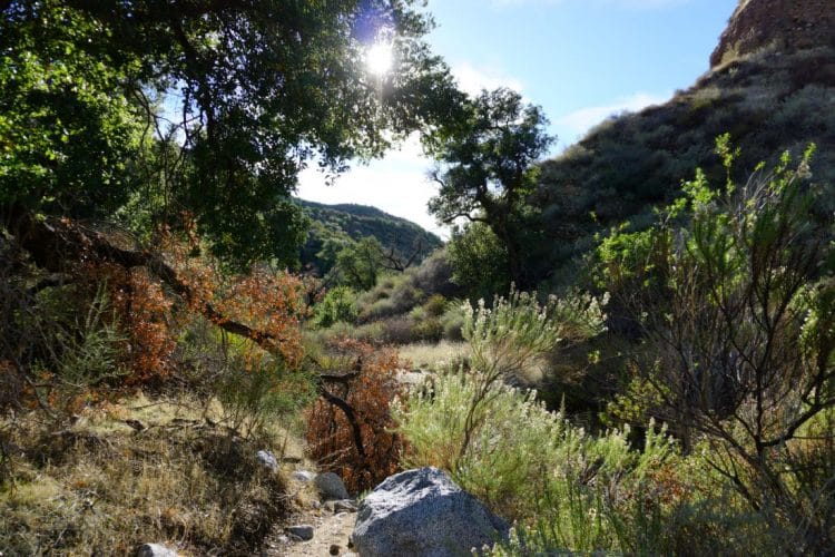
Whitney Canyon touts a long and varied history. Ranchers, Dairy Farmers, and Juvenile Offenders have all, at one point or another, called Whitney Canyon home. More recently, an Illegal Marijuana Grow Operation set up shop in the Canyon. Today, Whitney is a great place to go hiking, easily reached from both Santa Clarita, and the San Fernando Valley.
Whitney Canyon Map
Whitney Canyon Road Trail
Distance: 1.6 Miles one way. 3.2 Miles out and back.
Elevation Gain: 258 Feet
Time to Hike: Allow 2 hours.
Difficulty: Easy
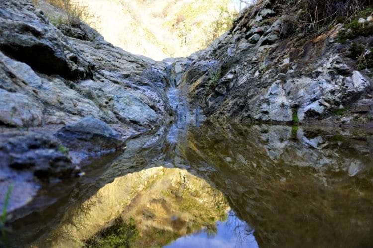
Although several trails can be hiked within Whitney Canyon, my favorite was hopping onto the Whitney Canyon Service Road, and following it as it travels into the depths of Whitney Canyon. This 1.5 mile, out and back trail parallels Whitney Canyon Creek before ending at a series of small waterfalls.
Gently rising just 250 feet over 1.6 miles, the Whitney Canyon trail is ideal for most hikers. The trail is obvious and well maintained. Only a few small creek crossings present potential obstacles.
The road passes some structural foundations-evidence of former activity in the canyon. Halfway into the hike, in a shady oak grove, the trail splits left from the service road. Follow this fork to the Canyon’s conclusion, or head right to parts unknown.
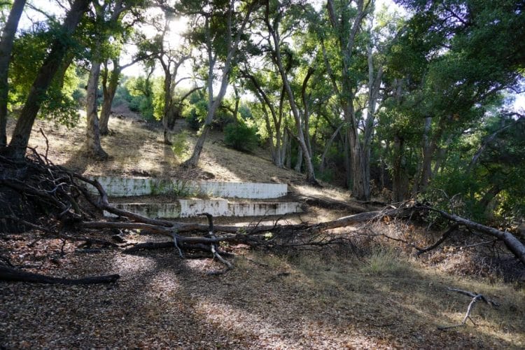
As you hike deeper, the canyon begins to narrow, and the brush grows thicker. The trail concludes at a cascading series of small waterfalls. Water flows in Whitney Canyon, like the rest of Santa Clarita, are only seasonal. Still, the Gneiss here has been worn to a slick sheen by untold millenia of winter storms. These rocks are slippery and steep. For your own safety, I do not recommend climbing any further.

Turn around here to head back to the parking lot, or diverge onto any one of the numerous side trails to explore more of Whitney Canyon.
Elsmere Canyon
Before I mention anything about Elsmere Canyon, I need to give credit to Stan Walker over at Elsmere Canyon.com. Mr. Walker has curated an impressive online library detailing the history, geology, and ecology of Elsmere, and surrounding areas.
Many of his articles are meticulously researched, having combed through old newspaper clippings, and long forgotten books. I would not be so well informed, if not for the work of Mr. Walker.
Creek Trail
Distance: 0.9 Miles one way. 1.8 Miles Out and Back.
Elevation Gain: 55 Feet
Time to Hike: 45 Minutes
Difficulty: Easy
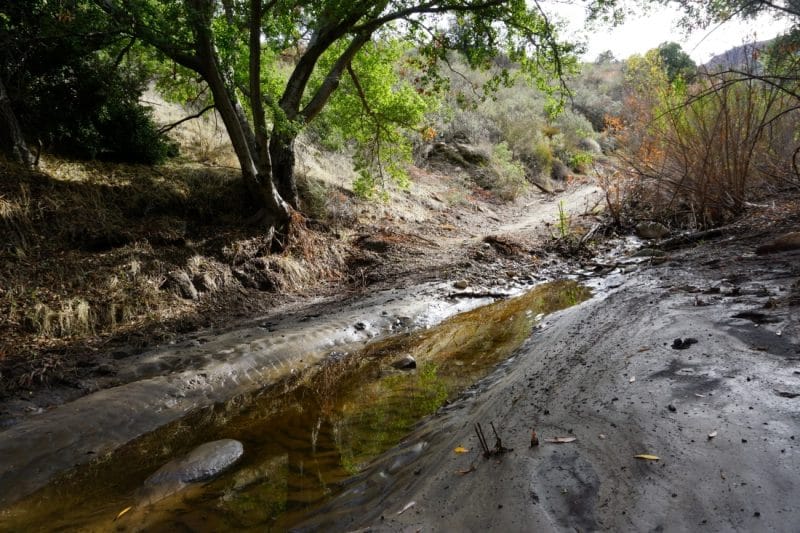
One canyon over from Whitney Canyon is the Elsmere Canyon Creek Trail. Beginning in the shady mouth of Elsmere, the Creek Trail is a gentle path into the heart of the canyon.
Along the way, hikers can travel along a calm, pleasant stream sheltered by abundant overgrowth. Overhead, a cave strewn cliffside, dripping with oozing black tar, creates a unique, backcountry ambiance.
I particularly enjoyed the creek trail. Water was flowing in the upper reaches of the canyon, where changing Fall colors made for a great morning walk. I recommend it highly.
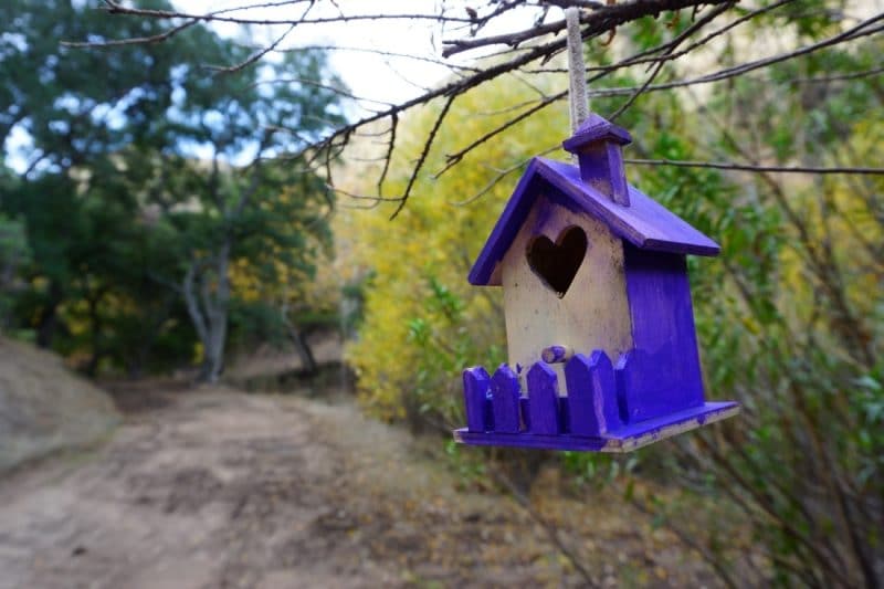
This trail is accessible for almost any hiker. The greatest hazard may just be slippery mud along the banks of the creek. It is difficult to lose your way here, as the path is well worn, and well marked by handmade signs from a local boy scout troop.
The trail ends where a large firebreak makes a steep path up the hillside. Some hikers may want to explore further, but I opted to turn around and see what the rest of Elsmere had to offer.
Elsmere Canyon Loop
Distance: 4.3 Miles
Elevation Gain: 920 Feet
Difficulty: Moderate
Time to Hike: Allow 2.5 hours, including time to enjoy the view.
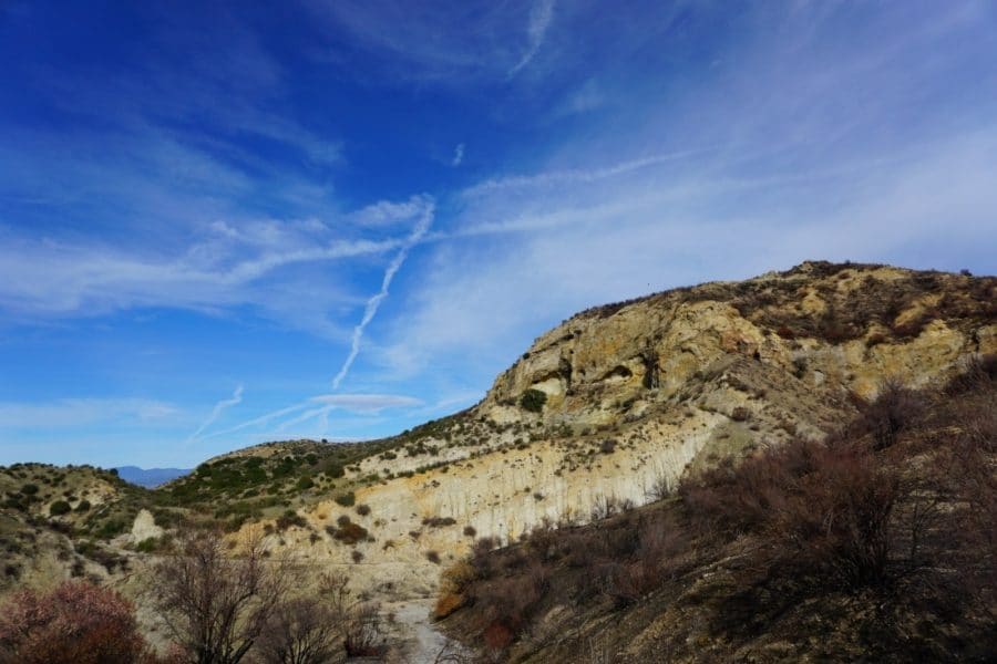
The Elsmere Canyon Loop is a 4.3 Mile trail wrapping about tall, sandstone buttresses. The Loop Trail shares a start with the Creek Trail, but diverges right, where the Creek Trail continues to the left. This is a great trail to get a good workout, see some great views, and visit some local history.
The Elsmere Canyon Loop trail begins by climbing an old service road, before a worn trail splits to ascend the hillside. A short series of switchbacks brings hikers to a ridge, where the trail then heads south. The trail comes to a bench, right before forking in two. Either trail will bring you back to the same point. I elected to take the left trail.
This portion of the Loop Trail climbs the top of those cliffs seen from below on the creek trail. If one so chooses, hikers can take a side trail to further explore the caves and tar seeps. I did not, but know that the trail is loose and steep. Venture at your own risk.
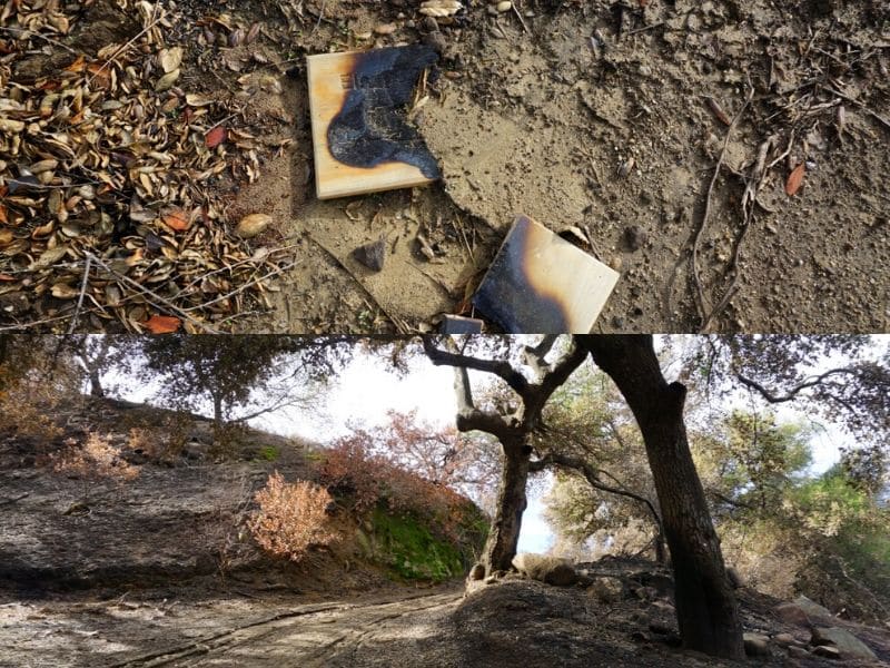
You will pass through a burn area before descending down into Elsmere Canyon, away from the freeway. It’s a little more quiet and shady down here, and a bench is present to help you stop and enjoy the surrounding nature.
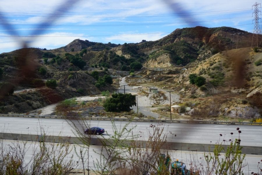
The trail continues up to a ridge overlooking the Newhall Pass. The trail then descends toward the freeway, where you will walk along a disused road. For the better part of a mile, this road parallels the 14 Freeway.
It may seem mundane to walk along the freeway, but this hike allowed me an interesting view of a road that I had always taken for granted. At night, this part of the loop trail might be a good place to get some cool long exposure photographs of the highway.
Take a moment to admire the rotted out, graffiti covered foundations located just across the freeway. These are the remains of the Newhall Oil Refinery. In its heyday, this was once an industrial giant, processing thousands of barrels of oil per day. Nowadays, it’s a toxic waste site.
Also, don’t confuse these crumbling, toxic remains with the Newhall Refinery–a decent brewpub located in downtown Newhall.
Further on, the trail continues under cliffs, and through canyons before climbing back up to the ridgeline. Follow the signs to return to the parking area.
Conclusion
A two for one deal, Whitney and Elsmere Canyons can be hiked together. Within these canyons are interesting examples of local geology, wildlife, and history. Both trails are easily reached from the 14 freeway, and most of the trails can be hiked in a day. Local hikers in Santa Clarita, San Fernando, and the Antelope Valley should devote a morning to exploring the extensive trail systems of Whitney and Elsmere Canyons!
- The Best Campsites Around Big Bear California - February 26, 2021
- Hiking to the Hollywood Sign Via the Brush Canyon Trail - July 13, 2020
- Dirt Cheap Hiking and Backpacking Gear: The Most Affordable Gear on the Internet - July 4, 2020
1 thought on “Whitney and Elsmere Canyons: Oil Refineries and Waterfalls”
Comments are closed.